Thursday, December 3, 2020

Rialto Beach

 August 24, 2020 Monday

We cooked a big and hearty breakfast in the Inn's kitchen and left the Inn about 10:00 headed for Rialto Beach. We retraced our drive from the prior day, north briefly on 101 and then west for several miles on 110. However today instead of the failed attempt to proceed on 110 to La Push, we turned on to Mora Road. On the way to Rialto Beach we crossed the Sol Duc and Dickey Rivers while frequently paralleling the Quillayute River which flows into the Pacific and passed . It also separates Rialto Beach, a/k/a Mora, from La Push. The scenery along the drive was scrub forest until we neared the coast, when the landscape turned to thicker forests with tall trees. It was about a 30 minute drive.

The road ended in a parking lot that was pretty crowded, but not full. There were picnic tables, water and restrooms at the parking lot. There was a short paved trail which took us over the dune and out to the beach. This was not a shoes off, sand between you toes beach. Rocky, and fairly wide at what seemed to be medium tide, there were lots of drift logs, some of them very large and others clustered together as if they were park of a child's pick-up-sticks game. Lots of gulls squawking and other sea birds patrolling the sky while the waves crashed and at times we were sprinkled with sea spray. Our view was immediately commanded by off shore rocks known as sea stacks which rose vertically out of the ocean. Behind us were towering trees and a lush undergrowth.


We decided to head north along the beach to Hole-in-the-Wall, a large rock formation, a sea carved arch. However the trail was along the beach and the tide was coming in so it became increasingly difficult to navigate the trail. Instead we turned around and headed south. We climbed among the driftwood, watched dogs romp in the water and I took a brief dip into the waves. After taking a break at a picnic table to eat the lunch we had prepared, we walked almost to the southern end of the beach From there we could see across the river to La Push and First Beach.


By the late afternoon we had finished our stroll and we returned to the Inn. I again parked the car behind the Inn and plugged in. We cooked dinner and ate on the balcony watching the sun set. Ate too much ice cream.


Tuesday, November 17, 2020

Hoh River Trail

Sunday August 23, 2020

This was another day when the virus and an Indian Reservation thwarted our plans.After a hearty breakfast cooked in the room's well stocked kitchen, the original plan was to drive through the Quileute Indian Reservation to the small town of La Push and then go to the beaches, First, Second and Third Beaches that lie just beyond the town. Supposedly spectacular vegetation, the Sitka, Spruce and evergreen trees, driftwood and ocean views. In furtherance of that we drove west on route 110, but at the fork to La Push Road we were warned of the road closure. The Indian reservation and the town were closed due to the virus. This time I heeded closure sign. We decided to retract our steps, return to route 101 and go south for short drive to the Hoh River Rain Forest which is one of the western entrances to The Park. The drive into the Along Upper Hoh Road to get to the Visitor Center was scenic and twisting and twice as long as the drive on the 101. It was very forested and hard to tell when private property ended and the park began as we periodically encountered residences and cabins during the drive.

The small parking lot was full so we drove back a little, parked on a side road and walked back to the Visitor Center. As usual during the pandemic, it was closed, but the Rangers were outside handing out maps and information. After a pit stop in the restroom we headed out on the Hoh River Trail, this area's main hiking trail. It is an out and back trail which parallels the Hoh River and extends 18.5 miles into the park. It ends at the Blue Glacier Moraine in the shadow of Mt. Olympus. We saw this glacier several days ago from Hurricane Ridge. There are several campgrounds along the trail, but we were returning to the inn that night.

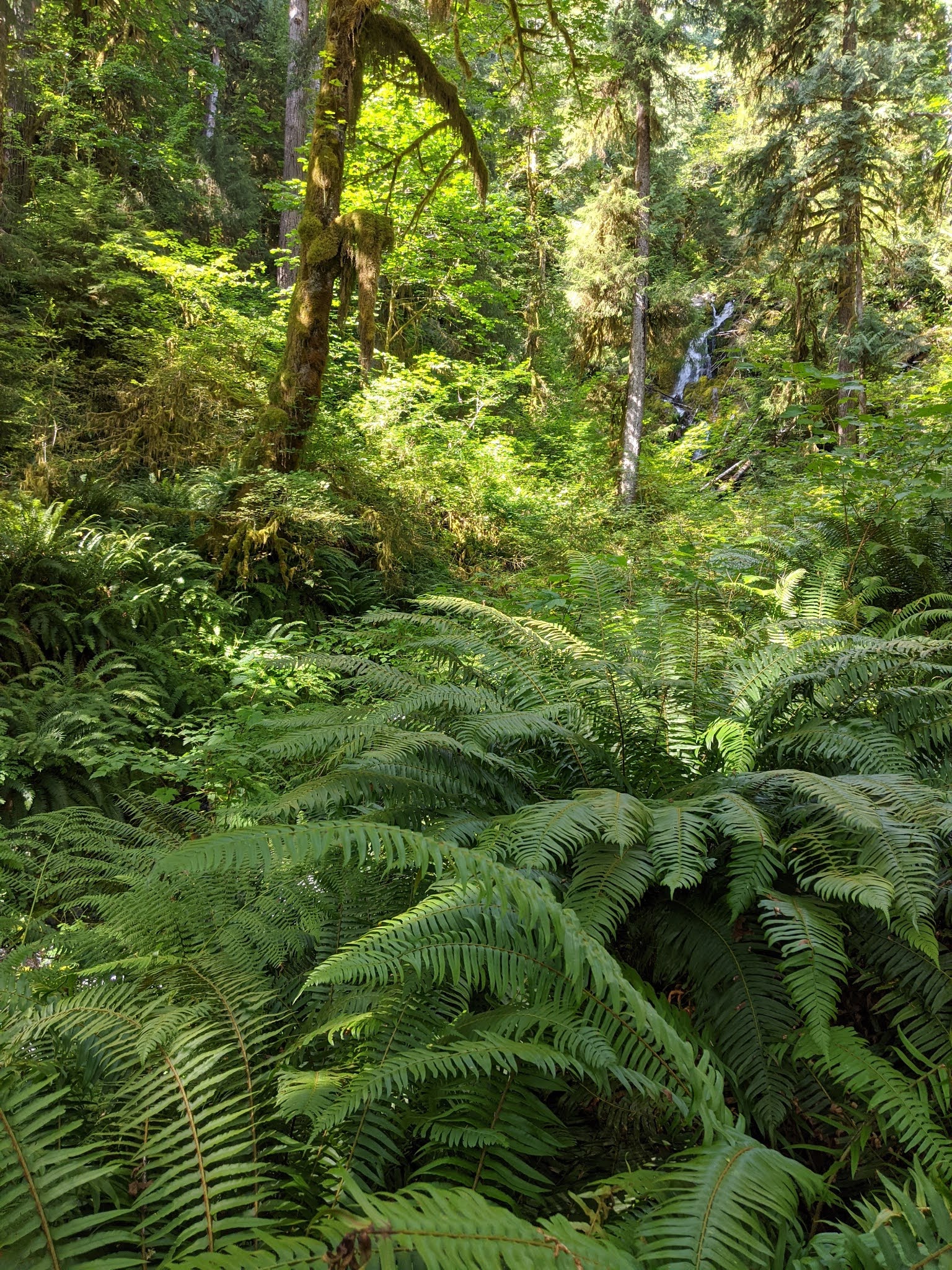
The Hoh Rain Forest gets its name from the ever flowing Hoh River which is fed both from melting glacier and winter rain. It flows from Mt. Olympus to the Pacific Ocean. The name is derived from Indian words meaning either: fast moving water; snow water; or man with quarreling wives. It rains frequently during the winter. The area receives an average of 140 inches of rain annually. As we got to experience during our hike, the result is a forest with a lush green thick canopy with both coniferous and deciduous trees that let in columns of sunlight. On the floor of the forest there are dense collections of mosses and ferns which slinky mosses hang from and cling to the tress all of which creates the environment of an enchanted forest. 


The Hoh River Trail passed through my impression of a classic temperate rain forest. Even though it was not raining it was very moist and at times it seemed as if moisture was dropping out of the trees from fog condensation in the canopy. We saw lots of nursery logs, large trees which had fallen and from which a few or many plants were growing out of. As we walked on the soft and largely flat trail we observed lots of slugs, snails,rodents and salamanders. Lots of birds overhead and a few deer, but otherwise no large animals which reputedly are present. Lots of giant trees, Sitka Spruce, Red Ceder, Big Leaf Maple and Douglas Fur (Kudos to the tree ID guides). Not many other hikers, but those we encountered either were wearing masks or put them on as we passed. There were a variety of green shades, lots of shade, but with a few columns of sunlight piercing down to the forest floor. The Trail paralleled the river and at times ran right along side it. We passed the First River Access milepost and continued on to Mineral Creek Falls, a distance of 2.7 miles.  After resting and snacking there, we retraced our steps back to the Visitor Center. Even on the same trail I am always surprised how different things look when walking in the opposite direction. 


It was getting late, so we passed on the popular, but short Hall of Mossess Trail and drove back to the Inn. We plugged the car in, cooked dinner and ate it while watching the sunset from our balcony.

Saturday, November 7, 2020

Around the Park, Lake Cresent and Forks

 August 22, 2020 Saturday

After 5 days in Port Angeles it was time to check out and move on. I was glad to have the last of the bag-o-breakfasts, but I did accumulate a stash of granola bars. With the repacking and dragging our stuff down the stairs we did not leave until 10:30. With a full car battery drove west for half an hour on 101 to Lake Crescent. The drive along the southern shore of the lake was spectacular and the sparkling, turquoise waters showcased the beautiful lake waters. 

 At the lake parking lot I was delighted to find a charging station and after parking and plugging in we walked over to the Lake Crescent Lodge. Built by the Singer family at the mouth of Barnes Creek on the southern shore of the lake it opened in 1915 as Singer's Tavern with seven Lodge rooms and several cabins. It cost $50,000 to build and furnish and for the first 7 years guests arrived by ferry. When the Olympic Highway reached the area in 1922 most guests arrived by automobile. Over time the facility was expanded. President Roosevelt visited in 1937 and stayed at the Lodge shortly before Olympic National Park was created which encompassed the Lake Crescent area. The Lodge was privately owned until 1951 when the National Park Service purchased it and the surrounding property for $95,000 and has subsequently added additional cabins and motel type rooms. The Inn's lobby was not as spacious or decorative as other historic lodges I have scene in national parks, but it was visually pleasant.

We walked down to the beach and then out on to the pier. The water was very clear, due to the low levels of nitrogen, but very cold. People were in the water, but no one was swimming, just jumping in and getting out. Lots of boats on the lake. On the other side of the lake is the Spruce Railroad Trail. A rail line was built there in 1918 to haul lumber for the war effort, but the war ended shortly after it was completed. A fright line operated for a few years, but as logging was restricted, it was converted into a hiking trail.

 The lake was formed when a landslide from Olympic Mountain dammed up a glacier valley. A subsequent landslide divided the lake in two forming Lake Sutherland. The Indian legend says that Storm King Mountain God was mad at feuding Indian tribes so he threw a boulder into the lake killing many of the warriors and dividing the lake in two.

We took the Moments in Time Trail along the lakefront which lead to a self guided nature trail through the forest. It was very green with an open forest floor, flat and soft. Crossing route 101 we got on the Marymere Falls Trail. This took us a mile through an old growth forest with an elevation gain of 400 ft almost all at the end. The Falls is 90 ft high and had a good water flow. We ended up on an overlook almost at the level of the top of the Falls which provided us with close ups of its roar and abundant water spray.  Perhaps because it was a weekend, there were quite a few people on the trail. Very few were wearing masks.


We then walked back to the car which had by then received a substantial charge and bypassing the Sol  Duc Falls and accompanying hot mineral pools (No matter how much time I allot to these trips there never is enough. One day I am going to take a trip with no reservations and no plan.) due to lack of time and the fact that we have seen many waterfalls and been in a number of hot springs, we took off south on scenic 101for Forks. This is a small town, less than 4000 residents, that was formerly a major logging center, but now is the gateway to the entrances to both the western parts of the Park and its Pacific Coast beaches. 

Forks was named because it is near the confluence of the Bogachief, Calawah and Sol Duc Rivers which become the Quillayute River, which flows into the Pacific Ocean. European settlers arrived in the area in the 1850s, but the first road was not built into the area until 1927 and it was not until 1931 when the Olympic Highway got there that there was effective land transportation into the town. With the decline of the logging industry, the major employers are two prisons and tourism. The latter got a major boost from the movie Twilight series which was based in the area, but largely not shot in the area. There is a twilight museum in town, along with a logging museum, but since the release of the first Twilight movie tourism has increased seven fold. I have not scene any of the Twilight films and have only the vaguest idea that they involve vampires.

There were not many restaurants in town. We ate an early dinner at Pacific Pizza on its outdoor patio. Very pleasant setting in the warm late afternoon sun and the food had generous portions and was a good value.  After eating we shopped at the local food market for our three day stay in Forks and then checked into the Olympic Suites Inn. I had looked for lodging in the morning and found few offerings. Very few Airbnbs and most of the hotels were either very high end or low end budget places, the former not worth it since we were not in the room most of the time and the latter too depressing for a 3 day stay. The Inn was an older, but well maintained property set in the woods next to a river. It was a two bedroom spacious unit with a well equipped kitchen, laundry facilities and a nice balcony. Easy to hang out there, watch the river go by and figure out the next days activities. As an added plus the desk clerk permitted me to drive the car around the back and charge it at a wall outlet. Slow charging, but adequate.


Tuesday, November 3, 2020

Port Townsend

August 21, 2020 Friday

Back to bag-o-breakfast at the hotel and charging up the car at the Chevrolet dealership. We got on the road about 11:15 and headed east on 101, retracing the route we drove in on Sunday night until Discovery Bay where we turned north on route 20. After a 44 mile drive we arrived in Port Townsend. I got lost driving into town and we ended up driving on Cherry Street to the north end of town driving through Fort Worden State Park. The fort was formerly part of the coastal defense system that defended Puget Sound. What we saw were lots of rhododendron plants, restored, very handsome Victorian homes along the former Officer's row and a large parade grounds. No military. Most of the scenes from An Officer and a Gentleman were filmed at the fort. I finally got myself righted and we drove down to the historic district passing scores of preserved Victorian homes.

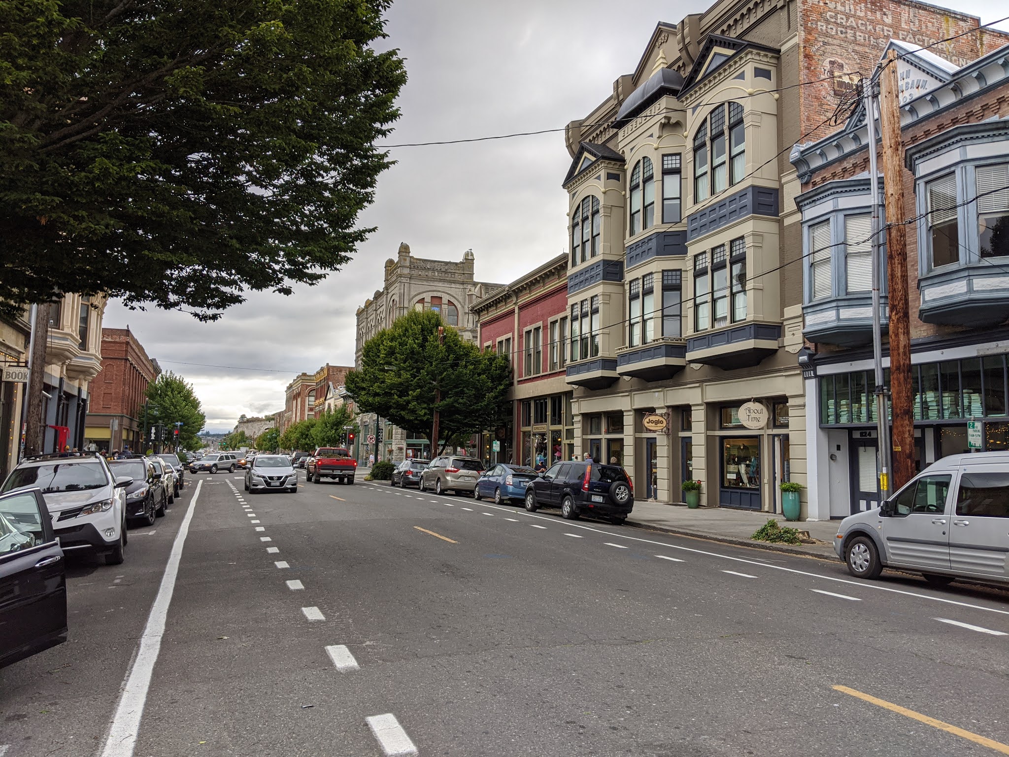
The presence of so many Victorian homes, more than any I have scene except for Eureka CA., provides a window into Port Townsend's historic rise, fall and then revival. The town was founded by Europeans in 1851. Located at the northeast corner of Quimper Peninsula which is at the northeastern part of the larger Olympic Peninsula, at the northern end of a large harbor, it was perfectly located to be both the guardian of Puget Sound and the major seaport for the northwest US. It got a fast start. By 1853 it had wrested the Customs House from Tacoma (it briefly lost this plum to Port Angeles) and over the next four decades it grew increasingly prosperous and populated as the growing seaport attracted banks, hotels, consulates, shipyards and commerce. As early as the late 1870s plans were made for it to become a western rail terminus of a northern transcontinental railroad, only to see those plans repeatedly fail. However in 1890 the city secured an agreement with the Union Pacific RR to become its western terminus and the city went wild. In a city of only 4,500 people, in the following year downtown real estate transactions (speculation?) totaled $4.600,000  including the building of 10 hotels, 3 street car lines, 6 hardware and dry goods stores and a new City Hall, plus hundreds of Victorian structures. Alas, that all came crashing down in the financial panic of 1893.  The rail subsidiary tasked with building the extension into town went into foreclosure and the rail lines ended up terminating on the east side of Puget Sound. The boom was over and commerce in Port Townsend came to a virtual standstill. Within 10 years the town's population declined by a quarter and the once fashionable Victorian homes that cost $25,000, were sold for a few hundred dollars, only to stand vacant for decades. The city's dreams of becoming the west coast's major port were forever dashed.  However this economic malaise ultimately, 80 years later, became the basis of the town's revival. Because of the rapid speed at which the economy declined in the 1890s and the lack of any significant economic activity to revive it, very few of the buildings in the area were torn down or built over and unlike many of the other cities in the northwest whose infrastructure succumbed to natural or man made disasters, Port Townsend's buildings were preserved. In 1976 many of its structures were listed on the National Register of Historic Places and the next year the entire downtown was designated as a National Historic Landmark. That lead to a revival of the area as a tourist and retiree destination. 

As we drove into the downtown area I found a charging station next to the marina in the northeast corner of town provided by Maritime Center and Power Trip Energy.  The S'Klallam Indians lived in the Port Townsend area for thousands of years and still reside there. In 1855 the Point No Point Treaty preserved their right to fish, hunt and gather in the area and there was a self guided interpretative Indian walking tour. We started that at Chetzemoka Park, the city's first park along the waterfront. The marina had lots of small boats including what appeared to be working fishing boats. 


We briefly toured the Northwest Maritime Center which had Indian artifacts including a totem pole and a canoe, but was largely closed. We walked out on the pier and found a crabber. We talked with him at length. He lives on the mainland, but comes out here regularly to crab. He explained the rules, limit of 6 crabs, had to be a certain size and no female crabs could be retained. He commented wryly about how his family expected him to deliver crabs.I was amazed at how casually he tossed the illegal crabs back into the water as he assured us that did not harm them. He let us toss some crabs, traps and pull in some lines.

It was a windy and cool day but mostly sunny and there was a single sun bather on the small beach. We walked up and down Washington, Jefferson and Water streets taking in the score of large, well preserved buildings including the Rose Theater, library, courthouse and federal building and street musicians. We stopped at the Elevated Ice Cream Co and then did some shopping at the community owned Quimper Mercantile Company. We saw the boats from the Washington State Ferry service take off and dock. 


We added 40 electric miles and took off for Port Angeles about 6:00.  After a gasoline refueling stop along the way back we parked the car at the dealership for some more electricity and walked over to Joshua's for dinner. We experienced extreme table spacing and very generous portions.

Saturday, October 24, 2020

Ozette Lake

August 20, 2020 Thursday

We passed up the hotel breakfast and ate at the Joshua Restaurant next door. Good food at reasonable prices with a 10% discount. Our plan for the day was to drive to Cape Flattery which offered interesting trails, views of lighthouses and going to the most northwestern point in the continental US. I though that we were to experience a two hour beautiful drive on slow curvy road along Juan de Fuca Strait. That was only partially fulfilled. After a short drive out of town we connected to State Highway 112, which follows the very scenic Strait of Juan de Fuca which connects Puget Sound with the Pacific Ocean and separates the Olympic Peninsula from Canada.  Its namesake has an interesting history. Given the name, I though he was Spanish. Not so. He was born in Greece after his grandparents fled from Constantinople in 1453 after its fall to the Ottomans because they were Christians. He became a mariner and entered the service of the Spanish king , initially in the Far East, but in 1587 his ship was captured by an English privateer and he was deposited in New Spain. Eventually he became a pilot in the Spanish Navy and at the direction of the Spanish Viceroy of New Spain he sailed north up the Pacific coast in search of the fabled Strait of Anian, which was allegedly the Northwest Passage. His first voyage ended in failure when the crew mutinied against the Army commander (Fuca was the pilot and master). However during his second voyage in 1592 he was successful in finding the Strait, although he misplaced its longitude). Upon his return de Fuce did not receive the rewards he felt that he had been promised. At the Viceroy's urging he went to Spain to plead his case for rewards, but was again unsuccessful. He toyed with a proposal to enter into the service of Queen Elizabeth's navy, but ultimately declined and returned to Greece where he died in 1602. The Strait was named for him by a British sea captain.

We drove along rugged cliffs on one side and the Strait on the other side. We saw eagles, some otters, but no whales.


In order to get to the trailhead for the cape we had to go through the Makah Indian reservation to the small town Neah Bay. However the virus intervened. Shortly after a road sign announced the town closing, we came to a checkpoint with a guard station manned by a what appeared to be a private security guard. He appeared to be Indian and he told us that we could not proceed because the town was closed to non-residents. I saw no point in arguing with him and assumed that the closure was due to a desire to minimize the spread of the virus on the reservation. So we turned around and retraced our route to the turn-off to Ozette Lake which we had mistakenly turned on to on our drive out. It was 21 miles to the lake area. The weather was not looking too good, a very gray sky and a heavy mist which at times molted into light rain. Thus I was surprised to see that the parking lot was almost full and there were quite a few people removing hiking and camping equipment from their vehicles. 

There were several deer loitering in a grassy area very near the parking area, seemingly oblivious to people. We used the bathroom, prepared the backpack and took our rain coats and umbrellas before starting the hike.


This location is part of the Pacific shoreline portion of the Olympic National Park. It is a narrow strip of land, just 6 miles at its widest point that runs for 60 miles along the wild and largely undeveloped Washington coast. While there was a Ranger station, we did not see any Rangers and payment of fees, entrance and camping, was on the honor system. 

From the trail map I learned that there were two trails to the ocean, Cape Alava and Sand Point and that one could walk both if you walked for 3 miles along the ocean, the Ozette Loop.  In total it would be 9 miles, too much in the early afternnon and with weather coming in, so we decided to just do the round trip Cape Alava trail, allegedly 6.2 miles. The trail is the western end of the 1200 mile Pacific Northwest trail which stretches from the Continental Divide in Montana to the Pacific Ocean during which it crosses three national parks, seven national forests, two other national trails, several mountain ranges and three states. This trail was designated as a National Recreation Trail in 1981 (not sure what that designation means) and at its end it is the western terminus at the westernmost point of the continental US. I was very impressed that I might be a small part of that.

Shortly after the trail began  we came to a moss covered bridge which crossed the Ozette River that flowed into Ozette Lake. The lake is 8 miles long and 3 miles wide. It is the largest unaltered lake in Washington.


The moss was a preview of the rain forest environment we were about to enter. About a quarter mile after the bridge we came to the trailhead sign.The bear warning only increased the apprehension level since we had just encountered a returning hiker who said that she had seen a bear.

We took the right fork. The forest we walked through was lush, green and wet. As usual with seemingly most of the forests in the US, this area was heavily logged into the early 20th century, but has regrown.


The weather was initially dry and the trail was packed gravel. However it began to rain lightly so we unfurled the umbrellas. Luckily, as we proceeded further into the forest the trail frequently became a beautiful ceder boardwalk. So we meandered through the forest under-story, largely shielded from the rain with lots of ferns, evergreens and red ceder trees.

After about 2.25 miles we came to the Ahlstrom's Prairie. This giant, soggy meadow was once farmed by two Swedish immigrants. Today all evidence of farming has given way to plants and animals. The final stretch was uphill, over a ridge. I strained to hear the roar or smell of the ocean as I knew that would be the end of the trail, but as the trail was more like 3.5 miles (that is what my pedometer said) it became a stagger to the end. However as we descended the ridge and I saw the ocean through the trees and heard its roar I felt a great sense elation and imagined that was what Lewis and Clark might have felt as they arrived at the Pacific coast.


The beach was rocky, foggy, windy and had a lot of driftwood. There even were some ducks paddling in the ocean. 


We spent a bit of time on the beach admiring the view and resting our legs. The weather was worsening, the rain was becoming steadier and it was approaching 4:30 pm, so we commenced the return trip. I was amazed that during our return trip we encountered several groups hiking in who were going to be camping that night. It appeared that it would be a rainy camp out. The wind broke my umbrella, but my raincoat kept my upper body dry. However the rain was steady and now dripping off the tress, so my shoes were a different story.


Some interesting sights on the way back. It is interesting how different things look when hiking in the opposite direction, but it was a pretty soggy trip back to the car.

We drove back to the hotel in the rain and arrived about 8:30, in time we thought to eat dinner at the Joshua restaurant adjacent to our hotel. However, even though the restaurant's posted hours were to 9:30, when we entered the adjacent bar (no food there) we were told that they closed early due to the virus. So dinner out of our food cooler.

Friday, October 23, 2020

Olympic National Park

August 19, 2020 Wednesday

The hotel's breakfast handouts were supplemented by our reheated pizza. Not the best way to start the day.

Charged up the car at the Chevrolet dealership while we ate breakfast. 

Following breakfast we set out for Olympic National Park, the primary reason for the trip. The Port Angeles entrance is the most popular one for park entrance and the Park Visitor Center was only a mile south of town. However it was closed due to the virus so we missed the hands on exhibits about the Park's history and biology. The Rangers were outside answering questions and handing out maps. 

The Park's origins go back to the later 19th century when President Grover Cleveland established the Olympic Forest Reserve, primarily in response to public outcry about the extensive logging going on in the area. The Washington State legislature was unable to implement further protections so President Roosevelt created the Olympic National Forest in 1907 and upgraded the area to a National Monument in 1909. Present FDR made the area a National Park in 1938, but illegal logging continued for several years thereafter. The Park still has a small ski area which has two rope tows and a poma lift. It is operated by a nonprofit and offers ski lessons.

The Park has four major geographic areas. While there are about a score of entrances to the Park, the majority of the Park is inaccessible by car. We were entering the biggest area, the center of the Park which has the highest mountains and receives over 400 inches of snow annually. As a result of the large snowfall there are many glaciers that cover the sides and ridge lines of these mountains, the tallest of which, Mt. Olympus rises to 7,965 ft. The three other areas are: the Pacific coast area which stretches 60 miles along the coast and is physically separated from the rest of the park; the temperate rain forests which receive over 150 inches or rain annually, the most in the continental US; and the eastern side of the park which has old growth forests, but is much dryer than the rest of the park.    

Armed with maps and a destination we drove a meandering 17 mile road up the Hurricane Ridge Road mountain. That drained all the electricity in the car battery. We parked at the Hurricane Ridge Visitors Center. Again, it was closed , except for the gift center and there were rangers outside. There was a patio with comfortable Adirondack chairs that offered wonderful panoramic views of the center of the Park. We sat there for while just taking in the view.

We then got back into the car and drove about 3 miles more to the end of the road. The primary parking area was full so we retraced our drive and parked at Picnic area B and walked back to the Hurricane Hill trailhead.  This is a 1.6 mile trail which takes you up 750ft. to Hurricane Hill. 5757ft. The Hurricane Hill trail project, a three year effort to restore this trail had been completed 8 days before we arrived. That made for a smooth, paved trail virtually all the way up. The trail was steep at times, but it offered spectacular views of the mountains and the Juan de Fuca strait out as far as Canada. There were lots of wildflowers, some animals and patches of snow. There were not a lot of people on the trail, but given the nicely paved trail we saw many wheelchairs and strollers being pushed along.  When we got to the top, we took time to sit and gaze at the view. A big view day.


It was a pleasant and easier walk back down. At the picnic area we retrieved food from our car and had a picnic lunch in the woods. There were several deer that wandered through the picnic area very close to people, but totally obvious to the humans in their mist.


We then rolled back down the mountain retracing our drive and picked up half a dozen electric miles through the regen feature on the car to highway 101. Then we proceeded west to the Elwha River Valley reached by Olympic Hot Hot Springs Road. We could only drive about 2 miles to the Madison Falls area due to a road closure caused by a road washout. 

The Elwha River has an interesting history. When the Europeans arrived in this area they found a 21 mile pristine river valley that was rich in 10 varieties of salmon and trout. In the early 20th century a Canadian entrepreneur saw in the river and its narrow gorges as an economic opportunity to  build dams to supply the increasing demand for electricity to power the lumber mills in Port Angeles. The Elwha Dam was finished in 1913 and a second dam, Glines Canyon, was finished in 1927. Lots of electricity, but contrary to state law there was no provision for the fish to swim and this spawn upstream. As the mills closed down and the adverse environmental impact of the dams became apparent, there was agitation to remove the dams. In 1992 Congress passed the Elwha River Restoration Act and by 2014 both of the dams had been removed. The cost of the dams' removal was 20 times the cost of their installation. The trout have returned in large numbers, but the salmon are still recovering.

 We parked and took a short walk on a paved trail to Madison Falls. 


 Driving back to town we took the back roads. There were hones out in the woods and many of them had Trump signs. Only saw on Biden sign. Located a charging station and walked around downtown. Lots of murals and sculptures.


 We ate dinner at the Downriggers restaurant on the waterfront. Good seafood with a view of the harbor.

Thursday, October 15, 2020

Port Angeles

August 18, 2020 Tuesday

The virus struck again. The hotel, which normally serves a hot buffet breakfast had eliminated that due to the virus and instead handed out requested items, beverages, fruit bars etc, to be eaten in our room. Not tasty, but somewhat filling and grabbed bars for the rest of the day. 

I identified a car charging station at a nearby Chevrolet dealer. I drove the car over there and the staff was very helpful. I had a conversation with several of them who were eating breakfast outside. They claimed that this dealership sells more electric cars than any other Chevrolet dealership in the state and that buyers come from out of state because of the dealership's outstanding service. Most of those whom I spoke with are fervent Trump supporters. They firmly believed that the Democratic governor's restrictions on activity was wrong and unconstitutional. Anyway, it was easy to charge up there.

My spouse was feeling tired so after I returned with the car I set out alone to explore Port Angeles. I drove threw town and parked in the park near the pier. The town has two long main streets running in parallel along the waterfront. It had a mixture of local businesses and chain fast food outlets. he park/pier area had a wealth of plaques and murals which described the area's history.

Port Angeles is the largest city in and county seat of Clallam County. Most of the county's 20,000 people live within the city's boundaries. I walked through the transit center and was surprised to discover an extensive bus network that seemed to run throughout the county. A Spanish explorer entered the harbor in 1791 and named it, but European settlers did not enter the area until the mid 19th century. The area got its big boost when Victor Smith convinced the then Secretary of the Treasury Salmon Chase to move the US Customs Port of Entry for the Territory of Washington from Port Townsend out  to Port Angeles. More patronage followed when they got President Lincoln to designate 3520 acres in the area as a federal reserve for a lighthouse and military purposes. That lead the Army Corps of Engineers to plot out a federal town plan and street plan which still exists. (That makes Port Angeles the only city other than Washington DC to be laid out by the federal government.)

Prosperity and growth followed, but then disaster struck. Victor Smith died in the sinking of the Brother Jonathan paddle steamer off the coast of California. Without its patron the Customs House was returned to Port Townsend and Port Angeles fell into obscurity for two decades. When the Puget Sound Cooperative Colony was established in 1887 growth resumed. Logging, lumber and pulp mills and shipbuilding powered the economy well into the 20th century. The mills began to close in the 70s and 80s and now one remains open. Tourism has become the major economic driver spurred by the construction of the Hood Canal Bridge cutting travel time to Seattle, ferry traffic to Victoria, Canada and increased popularity of Olympic National Park.  The area had and still has a significant presence in the area. Indeed the town's street signs were printed in both English and an Indian language.

However now the place was pretty quiet due to the virus. Many restaurants were closed, the ferry service to Canada has been idled and the sidewalks were pretty empty. The park had a small beach,("Hollywood Beach") a large pier and a tower that overlooked the Juan de Fuca Strait. I could see Canada from the tower. I encountered two older men with MAGA hats on and I asked them what they liked about Trump. They said he was a great man and that there was nothing he could do or say that would dissuade them from voting for him.They were from Idaho and very pleasant. I stoped for a burger and brew in the Barhop Brewing and Artisan restaurant. The bartender bemoaned the reduced tourism and said that normally the streets would be crowded and that there would be lots of people streaming off the ferry. He said that there had been a recent spike in virus infections in town and he worried if he would be able to remain in town if he lost his job.


                                             The idled ferry to Canada, a victim of US virus

After a few hours walking around town i returned to the hotel. However I got ansey again and again drove out to the park again. This time I walked west out of town to Ediz Hook, a spit of land that extends north and then east protecting the harbor and ending in the Coast Guard Air Station. I was not permitted to enter the Station. I walked around for a few hours again noting that there was a marijuana shop,  decorative windmills and a bridge memorializing a sister relationship with a Japanese city.


                                                    Canada in the distance
  I picked up dinner at Little Caesar's Pizza which was running a 2 for $10 Tuesday pizza special.