Saturday, October 24, 2020

Ozette Lake

August 20, 2020 Thursday

We passed up the hotel breakfast and ate at the Joshua Restaurant next door. Good food at reasonable prices with a 10% discount. Our plan for the day was to drive to Cape Flattery which offered interesting trails, views of lighthouses and going to the most northwestern point in the continental US. I though that we were to experience a two hour beautiful drive on slow curvy road along Juan de Fuca Strait. That was only partially fulfilled. After a short drive out of town we connected to State Highway 112, which follows the very scenic Strait of Juan de Fuca which connects Puget Sound with the Pacific Ocean and separates the Olympic Peninsula from Canada.  Its namesake has an interesting history. Given the name, I though he was Spanish. Not so. He was born in Greece after his grandparents fled from Constantinople in 1453 after its fall to the Ottomans because they were Christians. He became a mariner and entered the service of the Spanish king , initially in the Far East, but in 1587 his ship was captured by an English privateer and he was deposited in New Spain. Eventually he became a pilot in the Spanish Navy and at the direction of the Spanish Viceroy of New Spain he sailed north up the Pacific coast in search of the fabled Strait of Anian, which was allegedly the Northwest Passage. His first voyage ended in failure when the crew mutinied against the Army commander (Fuca was the pilot and master). However during his second voyage in 1592 he was successful in finding the Strait, although he misplaced its longitude). Upon his return de Fuce did not receive the rewards he felt that he had been promised. At the Viceroy's urging he went to Spain to plead his case for rewards, but was again unsuccessful. He toyed with a proposal to enter into the service of Queen Elizabeth's navy, but ultimately declined and returned to Greece where he died in 1602. The Strait was named for him by a British sea captain.

We drove along rugged cliffs on one side and the Strait on the other side. We saw eagles, some otters, but no whales.


In order to get to the trailhead for the cape we had to go through the Makah Indian reservation to the small town Neah Bay. However the virus intervened. Shortly after a road sign announced the town closing, we came to a checkpoint with a guard station manned by a what appeared to be a private security guard. He appeared to be Indian and he told us that we could not proceed because the town was closed to non-residents. I saw no point in arguing with him and assumed that the closure was due to a desire to minimize the spread of the virus on the reservation. So we turned around and retraced our route to the turn-off to Ozette Lake which we had mistakenly turned on to on our drive out. It was 21 miles to the lake area. The weather was not looking too good, a very gray sky and a heavy mist which at times molted into light rain. Thus I was surprised to see that the parking lot was almost full and there were quite a few people removing hiking and camping equipment from their vehicles. 

There were several deer loitering in a grassy area very near the parking area, seemingly oblivious to people. We used the bathroom, prepared the backpack and took our rain coats and umbrellas before starting the hike.


This location is part of the Pacific shoreline portion of the Olympic National Park. It is a narrow strip of land, just 6 miles at its widest point that runs for 60 miles along the wild and largely undeveloped Washington coast. While there was a Ranger station, we did not see any Rangers and payment of fees, entrance and camping, was on the honor system. 

From the trail map I learned that there were two trails to the ocean, Cape Alava and Sand Point and that one could walk both if you walked for 3 miles along the ocean, the Ozette Loop.  In total it would be 9 miles, too much in the early afternnon and with weather coming in, so we decided to just do the round trip Cape Alava trail, allegedly 6.2 miles. The trail is the western end of the 1200 mile Pacific Northwest trail which stretches from the Continental Divide in Montana to the Pacific Ocean during which it crosses three national parks, seven national forests, two other national trails, several mountain ranges and three states. This trail was designated as a National Recreation Trail in 1981 (not sure what that designation means) and at its end it is the western terminus at the westernmost point of the continental US. I was very impressed that I might be a small part of that.

Shortly after the trail began  we came to a moss covered bridge which crossed the Ozette River that flowed into Ozette Lake. The lake is 8 miles long and 3 miles wide. It is the largest unaltered lake in Washington.


The moss was a preview of the rain forest environment we were about to enter. About a quarter mile after the bridge we came to the trailhead sign.The bear warning only increased the apprehension level since we had just encountered a returning hiker who said that she had seen a bear.

We took the right fork. The forest we walked through was lush, green and wet. As usual with seemingly most of the forests in the US, this area was heavily logged into the early 20th century, but has regrown.


The weather was initially dry and the trail was packed gravel. However it began to rain lightly so we unfurled the umbrellas. Luckily, as we proceeded further into the forest the trail frequently became a beautiful ceder boardwalk. So we meandered through the forest under-story, largely shielded from the rain with lots of ferns, evergreens and red ceder trees.

After about 2.25 miles we came to the Ahlstrom's Prairie. This giant, soggy meadow was once farmed by two Swedish immigrants. Today all evidence of farming has given way to plants and animals. The final stretch was uphill, over a ridge. I strained to hear the roar or smell of the ocean as I knew that would be the end of the trail, but as the trail was more like 3.5 miles (that is what my pedometer said) it became a stagger to the end. However as we descended the ridge and I saw the ocean through the trees and heard its roar I felt a great sense elation and imagined that was what Lewis and Clark might have felt as they arrived at the Pacific coast.


The beach was rocky, foggy, windy and had a lot of driftwood. There even were some ducks paddling in the ocean. 


We spent a bit of time on the beach admiring the view and resting our legs. The weather was worsening, the rain was becoming steadier and it was approaching 4:30 pm, so we commenced the return trip. I was amazed that during our return trip we encountered several groups hiking in who were going to be camping that night. It appeared that it would be a rainy camp out. The wind broke my umbrella, but my raincoat kept my upper body dry. However the rain was steady and now dripping off the tress, so my shoes were a different story.


Some interesting sights on the way back. It is interesting how different things look when hiking in the opposite direction, but it was a pretty soggy trip back to the car.

We drove back to the hotel in the rain and arrived about 8:30, in time we thought to eat dinner at the Joshua restaurant adjacent to our hotel. However, even though the restaurant's posted hours were to 9:30, when we entered the adjacent bar (no food there) we were told that they closed early due to the virus. So dinner out of our food cooler.

Friday, October 23, 2020

Olympic National Park

August 19, 2020 Wednesday

The hotel's breakfast handouts were supplemented by our reheated pizza. Not the best way to start the day.

Charged up the car at the Chevrolet dealership while we ate breakfast. 

Following breakfast we set out for Olympic National Park, the primary reason for the trip. The Port Angeles entrance is the most popular one for park entrance and the Park Visitor Center was only a mile south of town. However it was closed due to the virus so we missed the hands on exhibits about the Park's history and biology. The Rangers were outside answering questions and handing out maps. 

The Park's origins go back to the later 19th century when President Grover Cleveland established the Olympic Forest Reserve, primarily in response to public outcry about the extensive logging going on in the area. The Washington State legislature was unable to implement further protections so President Roosevelt created the Olympic National Forest in 1907 and upgraded the area to a National Monument in 1909. Present FDR made the area a National Park in 1938, but illegal logging continued for several years thereafter. The Park still has a small ski area which has two rope tows and a poma lift. It is operated by a nonprofit and offers ski lessons.

The Park has four major geographic areas. While there are about a score of entrances to the Park, the majority of the Park is inaccessible by car. We were entering the biggest area, the center of the Park which has the highest mountains and receives over 400 inches of snow annually. As a result of the large snowfall there are many glaciers that cover the sides and ridge lines of these mountains, the tallest of which, Mt. Olympus rises to 7,965 ft. The three other areas are: the Pacific coast area which stretches 60 miles along the coast and is physically separated from the rest of the park; the temperate rain forests which receive over 150 inches or rain annually, the most in the continental US; and the eastern side of the park which has old growth forests, but is much dryer than the rest of the park.    

Armed with maps and a destination we drove a meandering 17 mile road up the Hurricane Ridge Road mountain. That drained all the electricity in the car battery. We parked at the Hurricane Ridge Visitors Center. Again, it was closed , except for the gift center and there were rangers outside. There was a patio with comfortable Adirondack chairs that offered wonderful panoramic views of the center of the Park. We sat there for while just taking in the view.

We then got back into the car and drove about 3 miles more to the end of the road. The primary parking area was full so we retraced our drive and parked at Picnic area B and walked back to the Hurricane Hill trailhead.  This is a 1.6 mile trail which takes you up 750ft. to Hurricane Hill. 5757ft. The Hurricane Hill trail project, a three year effort to restore this trail had been completed 8 days before we arrived. That made for a smooth, paved trail virtually all the way up. The trail was steep at times, but it offered spectacular views of the mountains and the Juan de Fuca strait out as far as Canada. There were lots of wildflowers, some animals and patches of snow. There were not a lot of people on the trail, but given the nicely paved trail we saw many wheelchairs and strollers being pushed along.  When we got to the top, we took time to sit and gaze at the view. A big view day.


It was a pleasant and easier walk back down. At the picnic area we retrieved food from our car and had a picnic lunch in the woods. There were several deer that wandered through the picnic area very close to people, but totally obvious to the humans in their mist.


We then rolled back down the mountain retracing our drive and picked up half a dozen electric miles through the regen feature on the car to highway 101. Then we proceeded west to the Elwha River Valley reached by Olympic Hot Hot Springs Road. We could only drive about 2 miles to the Madison Falls area due to a road closure caused by a road washout. 

The Elwha River has an interesting history. When the Europeans arrived in this area they found a 21 mile pristine river valley that was rich in 10 varieties of salmon and trout. In the early 20th century a Canadian entrepreneur saw in the river and its narrow gorges as an economic opportunity to  build dams to supply the increasing demand for electricity to power the lumber mills in Port Angeles. The Elwha Dam was finished in 1913 and a second dam, Glines Canyon, was finished in 1927. Lots of electricity, but contrary to state law there was no provision for the fish to swim and this spawn upstream. As the mills closed down and the adverse environmental impact of the dams became apparent, there was agitation to remove the dams. In 1992 Congress passed the Elwha River Restoration Act and by 2014 both of the dams had been removed. The cost of the dams' removal was 20 times the cost of their installation. The trout have returned in large numbers, but the salmon are still recovering.

 We parked and took a short walk on a paved trail to Madison Falls. 


 Driving back to town we took the back roads. There were hones out in the woods and many of them had Trump signs. Only saw on Biden sign. Located a charging station and walked around downtown. Lots of murals and sculptures.


 We ate dinner at the Downriggers restaurant on the waterfront. Good seafood with a view of the harbor.

Thursday, October 15, 2020

Port Angeles

August 18, 2020 Tuesday

The virus struck again. The hotel, which normally serves a hot buffet breakfast had eliminated that due to the virus and instead handed out requested items, beverages, fruit bars etc, to be eaten in our room. Not tasty, but somewhat filling and grabbed bars for the rest of the day. 

I identified a car charging station at a nearby Chevrolet dealer. I drove the car over there and the staff was very helpful. I had a conversation with several of them who were eating breakfast outside. They claimed that this dealership sells more electric cars than any other Chevrolet dealership in the state and that buyers come from out of state because of the dealership's outstanding service. Most of those whom I spoke with are fervent Trump supporters. They firmly believed that the Democratic governor's restrictions on activity was wrong and unconstitutional. Anyway, it was easy to charge up there.

My spouse was feeling tired so after I returned with the car I set out alone to explore Port Angeles. I drove threw town and parked in the park near the pier. The town has two long main streets running in parallel along the waterfront. It had a mixture of local businesses and chain fast food outlets. he park/pier area had a wealth of plaques and murals which described the area's history.

Port Angeles is the largest city in and county seat of Clallam County. Most of the county's 20,000 people live within the city's boundaries. I walked through the transit center and was surprised to discover an extensive bus network that seemed to run throughout the county. A Spanish explorer entered the harbor in 1791 and named it, but European settlers did not enter the area until the mid 19th century. The area got its big boost when Victor Smith convinced the then Secretary of the Treasury Salmon Chase to move the US Customs Port of Entry for the Territory of Washington from Port Townsend out  to Port Angeles. More patronage followed when they got President Lincoln to designate 3520 acres in the area as a federal reserve for a lighthouse and military purposes. That lead the Army Corps of Engineers to plot out a federal town plan and street plan which still exists. (That makes Port Angeles the only city other than Washington DC to be laid out by the federal government.)

Prosperity and growth followed, but then disaster struck. Victor Smith died in the sinking of the Brother Jonathan paddle steamer off the coast of California. Without its patron the Customs House was returned to Port Townsend and Port Angeles fell into obscurity for two decades. When the Puget Sound Cooperative Colony was established in 1887 growth resumed. Logging, lumber and pulp mills and shipbuilding powered the economy well into the 20th century. The mills began to close in the 70s and 80s and now one remains open. Tourism has become the major economic driver spurred by the construction of the Hood Canal Bridge cutting travel time to Seattle, ferry traffic to Victoria, Canada and increased popularity of Olympic National Park.  The area had and still has a significant presence in the area. Indeed the town's street signs were printed in both English and an Indian language.

However now the place was pretty quiet due to the virus. Many restaurants were closed, the ferry service to Canada has been idled and the sidewalks were pretty empty. The park had a small beach,("Hollywood Beach") a large pier and a tower that overlooked the Juan de Fuca Strait. I could see Canada from the tower. I encountered two older men with MAGA hats on and I asked them what they liked about Trump. They said he was a great man and that there was nothing he could do or say that would dissuade them from voting for him.They were from Idaho and very pleasant. I stoped for a burger and brew in the Barhop Brewing and Artisan restaurant. The bartender bemoaned the reduced tourism and said that normally the streets would be crowded and that there would be lots of people streaming off the ferry. He said that there had been a recent spike in virus infections in town and he worried if he would be able to remain in town if he lost his job.


                                             The idled ferry to Canada, a victim of US virus

After a few hours walking around town i returned to the hotel. However I got ansey again and again drove out to the park again. This time I walked west out of town to Ediz Hook, a spit of land that extends north and then east protecting the harbor and ending in the Coast Guard Air Station. I was not permitted to enter the Station. I walked around for a few hours again noting that there was a marijuana shop,  decorative windmills and a bridge memorializing a sister relationship with a Japanese city.


                                                    Canada in the distance
  I picked up dinner at Little Caesar's Pizza which was running a 2 for $10 Tuesday pizza special.

Monday, October 12, 2020

Beginning the Trip The Drive through Idaho and Oregon and to Washington

 August 16 and 17, 2020 To Washington State

I have long had a desire to visit Olympic National Park, both because I have been told and read that it has a wonderful variety of climates ranging from glaciers to a temperate rain forest, and that it has a very low visitation rate. The latter being a real positive in the age of the virus. I had scheduled the trip for this summer and had to reschedule twice, but now we were on our way.

We left from from our borrowed condo in Park City. This was our last day in that condo so we not only had to pack for the trip but we also had to clear out the condo. We finished packing up by 9:30 and drove down to our condo in SLC to unload some of our belongings and to leave one car packed with stuff in the garage. I also watered my tomato plants and picked up the mail. We left about 12:20, well be hind my hoped for departure.

We quickly got on to I-15 north and settled in for a long drive listening to podcasts, Malcolm Gladwell and Chuck Rosenberg, and satellite radio. After about 1.5 hrs we transitioned toI-84. This portion of the road seems to primarily go west, at one point it even intersects I-86 so I do not know why it has an even number. The drive was pretty boring and the landscape nondescript.

By dinner time we had exhausted our electricity and the gas gauge was getting low so we pulled off in Boise to gas up and eat dinner. I had intended to stop at a mall to eat, but its electric chargers were not working and on Sunday evening there were not many choices so we ate dinner at the Brixx Craft House. Lots of draft beers and good burgers and deserts. Not many people there and few masks.

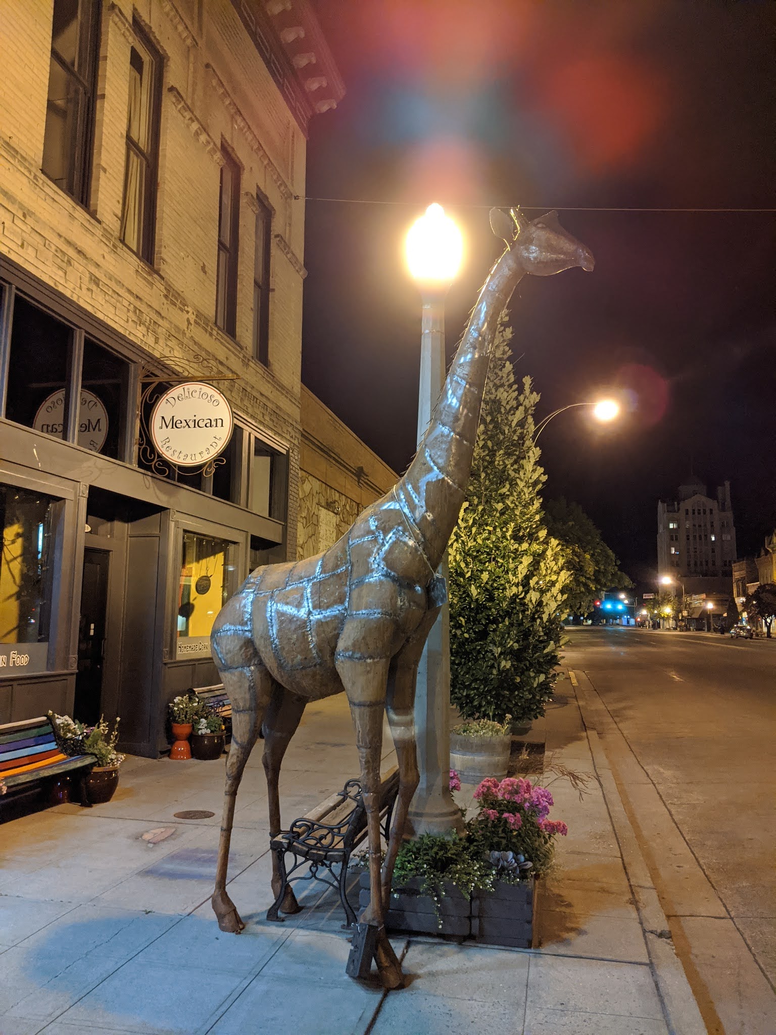
After about an hour in the restaurant we got back onto I-84 and drove for 2.25 hours into Oregon to Baker City. We picked up an hour as we crossed into the Pacific Time Zone and it was light for most of the drive.  We climbed for a good part of the drive through Oregon through heavily wooded mountains. Stay at the Oregon Trail Motel and Restaurant where we stayed in 2018. It had not improved and I was unable to charge up the car from our room since there was another car parked outside our room. After checking in and moving into our room, I walked into downtown and again viewed the Grand Geiser Hotel, where we had also stayed and eaten during a 2019 visit. Main street was well lit and I was surprised to find that since our last visit here the city had added almost a score of animal sculptures.


                                                    Grand Geiser Hotel
The next day I discovered that the car in front of our room had left early so I moved our car to get a few electric miles. We ate a good breakfast at the motel restaurant that was part of our hotel bill. The service was very good and the breakfast was tasty and filling. After breakfast we walked around town and along the river path, and saw the animal sculptures in daylight. At the Bella Main Street Market we did some shopping and purchased some Oregon wine. I noticed that the store clerk at the market had eaten at the restaurant. She told me that the animal sculptures were a recent addition, on loan form a local artist. By the time we got back to the motel it had gotten hot and the car had charged up to 9 miles. 

                                                Sculpture outside our motel
                                                The Market giving covid advice
                                             Not much activity in Baker City in the morning 

We resumed our trip and returned to I-84. We stopped first at highway arch and then a pioneer rest stop, Deadmans Pass, which had a lot of narrative displays about the Oregon Trail pioneers. This site was midway between an three day ascent and then a steep descent to the Umatilla River


For the next 3 hours we drove up through green forests in Oregon and then down into the Columbia River Valley where we crossed into the State of Washington and on to I-82. There the environment almost immediately changed to dry, hot and brown. For the next hour we passed lots of vineyards,fruit orchards and hops fields. The latter are grown on 7 ft high triangular supports. The other feature of the landscape were the thousands of produce boxes stacked along the farms to be loaded and similar boxes at teh food processing plants that were scattered along the interstate. We stopped in Yakima for refueling, both gasoline and electric, an early dinner and a cash withdrawal. We walked around downtown a bit, very hot and pretty deserted and ate at the Second Street Grill. Indoor eating is prohibited due the virus, but the shaded outdoor patio made for a pleasant dinner. The car was charged up to 18 miles courtesy of a free chamber of commerce charger. It was a GE charger, one I had never seen before.

Following dinner we returned to I-82 and began a 5 hour drive to our hotel. We passed over the twin span Fred Redmon Bridge spanning the Selah Creek which when completed in 1971 was the longest concrete arch bridge in the US and won an award "for excellence in the use of concrete". It was named for the first chairman of the Washington Highway Commission. All that information was courtesy of a stop in an overlook just after we crossed the bridge.


We transitioned to I-90 west and passed over the Snoqualmie pass, elevation 3022 ft. which receives a lot of snow in the winter, is frequently closed due to the snow and averages over 30 accidents a year. We did not have to deal with that, but as we were descending from the pass we noticed an extremely long traffic back-up going eastbound due to road construction. We were in the middle of no where in the Cascade mountains and while it was very green and beautiful, there are no other roads in this area so the eastbound traffic just inched along for miles. On the as of yet undetermined route back we will not take this road.

East of Seattle we turned south off of I-90 and circumvented both Seattle and Tacoma. Too many virus inspired closings in those cities to visit them. We rounded the southern end of Puget Sound and as we began our trip north up the Kitsap peninsula we crossed the Tacoma Narrows Bridge. This twin span, one built in 1950 and the other in 2007, replaced the original span which was build in 1940 and 4 months collapsed under 40 mph winds due to aeroelastic flutter. That event is the subject of a much viewed film  https://en.wikipedia.org/wiki/Tacoma_Narrows_Bridge_(1940)#Film_of_collapse. The State could not collect on one of its insurance policies on the bridge because its insurance agent had absconded with the premium. The only fatality was a dog, Tubby, which resisted rescue attemps and bit one of the would be rescuers. The owner of the last car on the bridge, and Tubby received a settlement of $50 for his lost car and $362 for its contents, including Tubby


 During the original bridge's short life it was the third longest suspension bridge in the US. The replacement bridge had tolls, but amazingly when the bonds were paid off the tolls were removed. Sadly after completion of the second span they were reinstated in 2007, but only for eastbound traffic so we did not pay them.

Following a winding and darkening drive north and then west on the Olympic Peninsula we arrived at our motel in Port Angeles about 9:00.


Tuesday, May 26, 2020

Toronto 1

June 29, 2019 Saturday Day 41

Woke up early and refreshed. The hotel was undergoing some renovation so its breakfast area was cramped, but the breakfast was terrific. Lots of selections from hot and cold dishes and lots of fresh fruit.

Toronto is a very big city. It is the provincial capital of Ontario, the commercial capital of Canada, has almost 3 million resident as and the metropolitan region has almost 6 million. It got started as a French trading outpost in the mid 18th century, but was acquired by the British following the British victory in the Seven Years War between France and Great Britain in 1763 (known in America as the French and Indian War). it was made the capital of Upper Canada. It was named York after the Duke of York, but renamed Toronto in 1834, reverting to its native name . There was a large influx of settlers from the United States after the Revolutionary War by United Empire loyalists who wanted to remain with Great Britain.  In 1813 during the War of 1813 it was successfully invaded by the Americans who burned down the legislative buildings. In retaliation the British burned the White House in Washington DC the following year. in 1837 it was the center of the Upper Canada rebellion against British colonial rule. (I guess the loyalists' decedents saw things differently their elders.) It was briefly the capital of colonial Canada before that status was transferred to Ottawa as part of the process of Canada obtaining its independence. Through  the first two thirds of the 20th century Toronto grew through immigration, but its population and economic importance still remained second behind the much longer established Montreal. However due in part to the political and economic uncertainty raised by the Quebec sovereignty movement, many businesses moved their activities from Montreal to Toronto and by 1980 Toronto had surpassed Montreal in population and had become Canada's chief economic hub.  Toronto has more skyscrapers including high rise residences than any other city in North America

After breakfast we walked down to Yonge St to Harbourfront Centre/Queen's Quay Terminal where we encountered the International Tall Ships festival. For a small price we gained admission to a score of ships of varying sizes, designs and functions. Most of the ships were sponsored by organizations that were not Canadian, one was sponsored by the port of Baltimore, and were used for training and/or publicity purposes. Several offered members of the public the opportunity to work on the ships, essentially summer camps for adults. This was just one of many stops for most of these ships to ports around the world for similar festivals.
The CN Tower is the tallest structure in North America


After a few hours touring boats and talking with the crews, we walked along the waterfront on Queens Quey E into the Old Town neighborhood. We stopped at a park which had music and festival booths. The music was bluegrass. There was a New York State tourism booth and I won some swag including a hat by winning a trivia contest. We continued east on the waterfront to Sugar Beach Park which had a lot of street performers. Sort of a cleaned up Venice Beach.

We then headed away from the lake front to the St. Lawrence Market.  This was sort of a larger and upscale Grand Central Market, but not too much was open on a Saturday holiday weekend afternoon. However we were able to sample the signature Toronto sandwich at the Carousel Bakery. Mainly cured bacon rolled in cornmeal flower. Not to my liking, but better than the French fries and cheese curdles, poutine that is a Canadian national dish. We shopped at the Metro supermarket purchasing ice cream, wine and assorted snacks.

We ate the former at a small park at the back of the historic Flatiron Building. This five story building was built in 1891 by the Goodenham family which made their fortune in the distillery business. It was completed a decade before the much taller Flatiron building in NYC. It has a tunnel under the street to the a bank also owned by the family so the family could move large bags of cash without going outside. There is a mural on the back of the building that is a mirror image of the building across the street. That creates an optical illusion, trompe l'oeil (trick of the eye) in which something appears real when it is not. The building was designated as a National Historic Site in 1975 which saved it from demolition when all around it apparently were demolished. Now it stands as the only older building among a forest of modern structures.
   
It was early evening but still very light so on the way back to the hotel we stopped off at Cantina Mercatto for some drinks and a light dinner. After more progress to the hotel we sat in a park eating and drinking and people watching. The predominant temperature throughout the day was hot while the  predominate language throughout the day was English.
Watching the people watching the fountain
We walked over 7 miles during the day. However by the time we arrived back to the hotel at 9:47 it was still light.

Sunday, May 24, 2020

To Toronto

June 28, 2019 Friday Day 40

Woke up early without any bed bites or sleep interruptions, so the motel served its purpose. I checked on the car which I had plugged into an outside outlet at the far end of the motel and it was still slowly charging. I then went for a swim in the motel's indoor pool. It was a nice size but very humid and chlorinated. The deck was being rebuilt.

Then went to the breakfast area and were greeted by a mob of Sikhs. The motel was hosting a bus tour of Sikhs from the Punjab in India. They were virtually all male and primarily older. They were from a seniors club and were dressed in Sikh style clothing. There was no one in the breakfast area except us who was not part of that group. The tour guide was a Indian-Canadian who had immigrated to Canada over 40 years ago. We spoke at length, he seemed to welcome the break from the Sikhs, and he recounted the difficulties and discrimination he had experienced in Canada, but he also expressed his gratitude for the good life Canada had afforded him. He said that the travelers were on a two week visit to Canada and were up from Toronto for two days and one night.

The breakfast was a chaotic affair. At one point my wife's English muffin was squished down in the toaster by another guest's bread. The food area was pretty messy, spreads like peanut butter were being taken right out of the jar and the owner was furiously, but unsuccessfully trying to resupply the food. At least the breakfast had fresh fruit and was filling.

After breakfast we quickly packed up and exited for downtown with a 48 mile electric charge. We took Parry Sound Drive, Joseph and Isabella streets, the latter going under a high railway trestle into a very cute downtown.

The town is located on Parry Sound, which has the deepest, natural, freshwater port in the world. The town is named after the sound which was named by Captain Henry Bayfield, yes he of Bayfield WI fame which we passed through earlier in the week, for William Parry, an Artic explorer.  The town has a permanent population of about 6,400, that swells considerably during the summer. For the first part of the 20th century area's economy was centered on explosives and munitions plants. Today tourist is the main economic driver.

We parked by the harbor and observed the great lake cruise ships. The sound opens up to Georgian Bay, which has 30,000 islands. and then out to Lake Huron.

Then we walked through a park and entered a local historical museum. At the other end of the harbor is the Bobby Orr  Hall of Fame. He was a great hockey player who was born and raised in Parry Sound and played his entire career with the Boston Bruins. Pretty small and pricy, $9, but a must see if you are a Bobby Orr fan. After quick stops in the gift and ice cream shops, we took a stroll on the Fitness Trail which roughly parallels the shoreline and provided nice views of the bay.


We then drove through town and exited at the southern end and resumed our drive to Toronto. Back on the highway it was a long, monotous drive through very green, but flat brush and new forests. As we got closer to Toronto farms began to appear.  We stopped for a Subway sandwich lunch and gasoline as it began to rain.

As we approached Toronto during rush hour we encountered major traffic congestion, both going into and out of town.

Toronto sort of took me by surprise. I knew that it is a major metropolitan area, but I had never been there and was not prepared for what I saw. Perhaps it was because we had really not been in a major city since Minneapolis. My first vision of the city was forests of residential towers and lots of construction cranes.

We entered the entertainment district, south of the downtown business area on an elevated freeway that ran past lots of sleek glass and steel office buildings and more residential high rises.  Found our hotel without problem, but had to unload in the rain and park around the block in an underground garage to avoid a $45/day parking charge at the hotel. We had reserved a room in the Executive Hotel Cosmopolitian, a former apartment building so we have a spacious suite with a nice view. The hotel is at 8 Colborne Street, a narrow street, in the heart of downtown. Various taxes amounted to 24% of the bill.

After unpacking we walked around the downtown. I felt like a tourist gazing up at the tall buildings and people watching the well dressed pedestrians. Very much like New York City or San Francisco. Entering the westside neighborhood we passed through Union Station, a large handsome edifice, which was still crowded with passengers and were headed in the direction of the Rogers Center to see if we could get in and see the baseball game. Toronto Blue Jays vs. the Kansas City Royals. Two teams having very poor seasons and going no where in the standings. As we approached the stadium a young man solicited us to purchase his two season tickets. They were very good seats, 5th row box, slightly down the line from first base. He was seeking $120 a piece  for them. I expressed interest in the seats, but not the price. We had an extended negotiation and he reduced the price, but not to a level I was interested in, so I walked away. Shortly thereafter he pursued us and we agreed on a price of $80 US. Thus we watched the Blue Jays pull out a come from behind 6-2 win. Two, loud, but joyful Royals fans 2 rows behind us who had traveled to Toronto from Kansas City primarily they said to see the game were very disappointed. The ballpark was completed in 1989 and was the first with a fully retractable motorized roof. One outfield wall is the wall to a luxury hotel. We could see some of the hotel guests in their rooms.  Weird seeing a baseball game indoors on artificial turf. Little noise in the stadium, less than 19,000 in attendance and no organ or piped in music. We purchased some Labatt beer and fries. Usual ballpark exorbitant prices. However it was bobblehead night and we were given two of them which we will mail to the grandkids when we return to the US.

Sculpture on the outside of the stadium


This was the beginning of Canada Weekend so the town seemed to be emptying out and after the game many of the restaurants were closed. late  We ate a late dinner at the Irish Embassy Pub and Grill. Reasonable food and low priced beer. Then walked back to our hotel.

Monday, May 18, 2020

Across Ontario

June 27, 2019 Thursday Day 39

We got up relatively early, ate a hardy breakfast of eggs and fruit, packed up, collected the 50 yards of extension cords that helped to charge up the car to 48 miles. Initially we drove around the Canadian Sault Ste Marie. It is much larger and more prosperous looking than the US side. Lots of large and well maintained homes and modern and multi-story buildings. Then we set out to explore the northern shore of Lake Huron in Ontario, Canada.

I had not planned to take this route as my original plan was to drive south through Michigan passing through Detroit and to enter Canada Windsor.But Detriot was not exciting, most of Michigan looked like flat farmland or depressed factory towns, so I decided that we would explore the great open area north of Lake Huron. However I had no maps, guide books for or reservations in that part of Canada. Thus our first stop was the Ontario visitor center to get maps and tourist books for the area. That was located next to casino to which we walked to change US for Canadian money. A very favorable exchange rate.

It turned out that while this area of Canada is great for boating swimming, fishing and camping, there is not much else there.

Outside of town we got on the Trans-Canada Highway, a 4,860 mile mostly four lane divided highway that is the only road which connects eastern and western Canada. It stretches in the east  from St. John's, Newfoundland, then to the mainland by way of a ferry and ultimately to Victoria BC in the west. It has different numbers throughout most of the 10 provinces (it does not go to any of the Canadian territories), but throughout it has a distinctive white-on-green maple leaf markers.

The drive was relatively flat and accompanied by endless green forests. There was little traffic. While we rarely saw it, we were following the northern shore of Lake Huron and there were  periodic signs for vacation spots on the many islands. We passed a few small towns, Bruce Mines, Blind River and Spanish, but did not enter any until we arrived at Massey, a non-descript town of about 1000 residents that is the gateway to Chutes Provincial Park.

The Park is named after the logging chutes that diverted logs around the waterfalls and other obstacles on the Aux-Sables River. From the late 1800s until the 1930s this was a major logging area. Trees, mainly pine, were toppled and dragged on to the ice covered river. Each logging company branded its logs. In the spring, when the river was at its highest level the logs were floated down the river to the mouth of the Spanish River, then to Lake Huron where they were towed by tug boats to sawmills. The logs were shepherded down the rivers by the Whitewater Men. Their duties included minimizing the damage to the logs while then traveled and to minimize jams which cold occur when logs got caught on obstacles.  There were pictures of the Men working on the logs on the river with long pikes maneuvering the logs.

The main attractions in the park were its waterfalls and rapids. There was a nice trail network and we took a long stroll through the park enjoying the water and the verdant vegetation. The water level was down considerably from its height in early spring.   We also had a little picnic. There was also an exhibit at the Graveyard Rapids which described the log-driving era and the hazards that the Whitewater Men experienced.


After exiting the park we returned to Massey and sought a place for an early dinner. There were not many choices. We selected the Dragonfly Restaurant. It had outdoor dining and an extensive menu. Lots of dragonflies hanging from the ceiling. A nice dining experience. The pasta was very good and the portions generous. Our waitress was a young girl who said there was nothing to do in town. She was planning on leaving as soon as she could.

After dinner we got back on the highway and continued east passing Sudbury where the highway forked. We turned south and desiring to get to Toronto the following day, bypassed Sudbury, the largest city in the area and a nickel mining center.

Throughout this and prior trips I frequently did not make lodging reservations until a few days in advance, or in some cases on the actual day. It had never been a problem and we always had secured acceptable lodging. Due to the late decision to take this route, my unfamiliarity with the area and no idea of where we would be, I had not made a lodging reservation for this night. As we drove through
a very rural and wooded area with infrequent and very small towns whose accommodations seemed to be exclusively summer camps and fishing and hunting lodges we were having difficulty securing lodging. I began t ear that we would be camping in the car that night. We arrived in Parry Sound about 8:00 pm. Not many choices. We finally landed at a Canadian Best Value Inn and Suites. Neither a good value nor a desirable place to lay ones head.

After checking in we drove and walked around a portion of Parry Sound until we ran out of daylight. A very cute town with an expansive waterfront.