Tuesday, November 17, 2020

Hoh River Trail

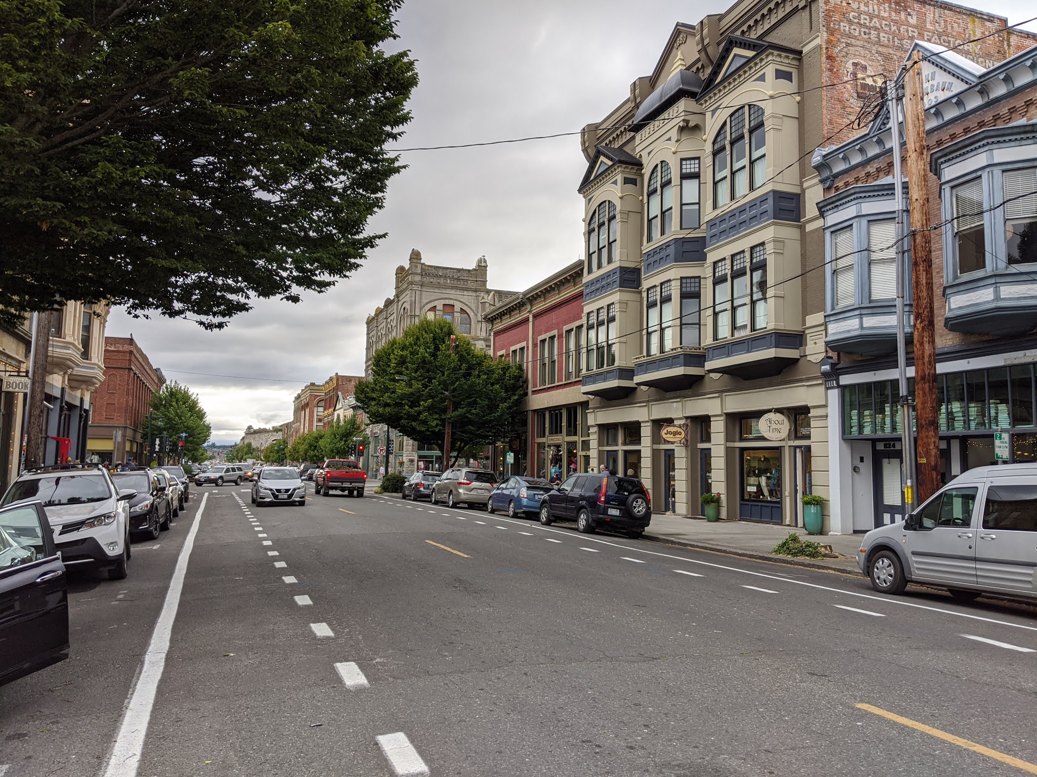
Sunday August 23, 2020

This was another day when the virus and an Indian Reservation thwarted our plans.After a hearty breakfast cooked in the room's well stocked kitchen, the original plan was to drive through the Quileute Indian Reservation to the small town of La Push and then go to the beaches, First, Second and Third Beaches that lie just beyond the town. Supposedly spectacular vegetation, the Sitka, Spruce and evergreen trees, driftwood and ocean views. In furtherance of that we drove west on route 110, but at the fork to La Push Road we were warned of the road closure. The Indian reservation and the town were closed due to the virus. This time I heeded closure sign. We decided to retract our steps, return to route 101 and go south for short drive to the Hoh River Rain Forest which is one of the western entrances to The Park. The drive into the Along Upper Hoh Road to get to the Visitor Center was scenic and twisting and twice as long as the drive on the 101. It was very forested and hard to tell when private property ended and the park began as we periodically encountered residences and cabins during the drive.

The small parking lot was full so we drove back a little, parked on a side road and walked back to the Visitor Center. As usual during the pandemic, it was closed, but the Rangers were outside handing out maps and information. After a pit stop in the restroom we headed out on the Hoh River Trail, this area's main hiking trail. It is an out and back trail which parallels the Hoh River and extends 18.5 miles into the park. It ends at the Blue Glacier Moraine in the shadow of Mt. Olympus. We saw this glacier several days ago from Hurricane Ridge. There are several campgrounds along the trail, but we were returning to the inn that night.

The Hoh Rain Forest gets its name from the ever flowing Hoh River which is fed both from melting glacier and winter rain. It flows from Mt. Olympus to the Pacific Ocean. The name is derived from Indian words meaning either: fast moving water; snow water; or man with quarreling wives. It rains frequently during the winter. The area receives an average of 140 inches of rain annually. As we got to experience during our hike, the result is a forest with a lush green thick canopy with both coniferous and deciduous trees that let in columns of sunlight. On the floor of the forest there are dense collections of mosses and ferns which slinky mosses hang from and cling to the tress all of which creates the environment of an enchanted forest. 


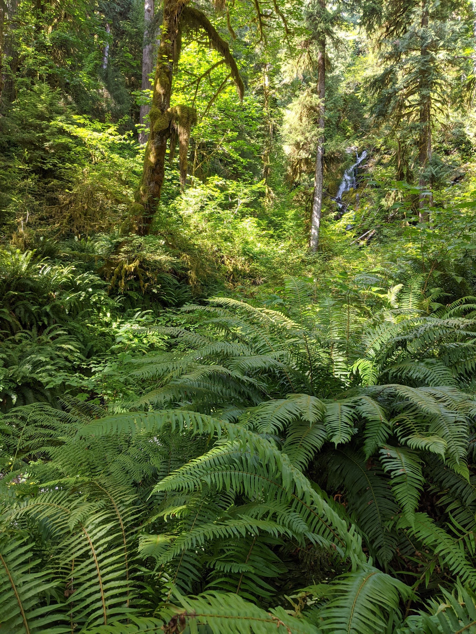
The Hoh River Trail passed through my impression of a classic temperate rain forest. Even though it was not raining it was very moist and at times it seemed as if moisture was dropping out of the trees from fog condensation in the canopy. We saw lots of nursery logs, large trees which had fallen and from which a few or many plants were growing out of. As we walked on the soft and largely flat trail we observed lots of slugs, snails,rodents and salamanders. Lots of birds overhead and a few deer, but otherwise no large animals which reputedly are present. Lots of giant trees, Sitka Spruce, Red Ceder, Big Leaf Maple and Douglas Fur (Kudos to the tree ID guides). Not many other hikers, but those we encountered either were wearing masks or put them on as we passed. There were a variety of green shades, lots of shade, but with a few columns of sunlight piercing down to the forest floor. The Trail paralleled the river and at times ran right along side it. We passed the First River Access milepost and continued on to Mineral Creek Falls, a distance of 2.7 miles.  After resting and snacking there, we retraced our steps back to the Visitor Center. Even on the same trail I am always surprised how different things look when walking in the opposite direction. 


It was getting late, so we passed on the popular, but short Hall of Mossess Trail and drove back to the Inn. We plugged the car in, cooked dinner and ate it while watching the sunset from our balcony.

Saturday, November 7, 2020

Around the Park, Lake Cresent and Forks

 August 22, 2020 Saturday

After 5 days in Port Angeles it was time to check out and move on. I was glad to have the last of the bag-o-breakfasts, but I did accumulate a stash of granola bars. With the repacking and dragging our stuff down the stairs we did not leave until 10:30. With a full car battery drove west for half an hour on 101 to Lake Crescent. The drive along the southern shore of the lake was spectacular and the sparkling, turquoise waters showcased the beautiful lake waters. 

 At the lake parking lot I was delighted to find a charging station and after parking and plugging in we walked over to the Lake Crescent Lodge. Built by the Singer family at the mouth of Barnes Creek on the southern shore of the lake it opened in 1915 as Singer's Tavern with seven Lodge rooms and several cabins. It cost $50,000 to build and furnish and for the first 7 years guests arrived by ferry. When the Olympic Highway reached the area in 1922 most guests arrived by automobile. Over time the facility was expanded. President Roosevelt visited in 1937 and stayed at the Lodge shortly before Olympic National Park was created which encompassed the Lake Crescent area. The Lodge was privately owned until 1951 when the National Park Service purchased it and the surrounding property for $95,000 and has subsequently added additional cabins and motel type rooms. The Inn's lobby was not as spacious or decorative as other historic lodges I have scene in national parks, but it was visually pleasant.

We walked down to the beach and then out on to the pier. The water was very clear, due to the low levels of nitrogen, but very cold. People were in the water, but no one was swimming, just jumping in and getting out. Lots of boats on the lake. On the other side of the lake is the Spruce Railroad Trail. A rail line was built there in 1918 to haul lumber for the war effort, but the war ended shortly after it was completed. A fright line operated for a few years, but as logging was restricted, it was converted into a hiking trail.

 The lake was formed when a landslide from Olympic Mountain dammed up a glacier valley. A subsequent landslide divided the lake in two forming Lake Sutherland. The Indian legend says that Storm King Mountain God was mad at feuding Indian tribes so he threw a boulder into the lake killing many of the warriors and dividing the lake in two.

We took the Moments in Time Trail along the lakefront which lead to a self guided nature trail through the forest. It was very green with an open forest floor, flat and soft. Crossing route 101 we got on the Marymere Falls Trail. This took us a mile through an old growth forest with an elevation gain of 400 ft almost all at the end. The Falls is 90 ft high and had a good water flow. We ended up on an overlook almost at the level of the top of the Falls which provided us with close ups of its roar and abundant water spray.  Perhaps because it was a weekend, there were quite a few people on the trail. Very few were wearing masks.


We then walked back to the car which had by then received a substantial charge and bypassing the Sol  Duc Falls and accompanying hot mineral pools (No matter how much time I allot to these trips there never is enough. One day I am going to take a trip with no reservations and no plan.) due to lack of time and the fact that we have seen many waterfalls and been in a number of hot springs, we took off south on scenic 101for Forks. This is a small town, less than 4000 residents, that was formerly a major logging center, but now is the gateway to the entrances to both the western parts of the Park and its Pacific Coast beaches. 

Forks was named because it is near the confluence of the Bogachief, Calawah and Sol Duc Rivers which become the Quillayute River, which flows into the Pacific Ocean. European settlers arrived in the area in the 1850s, but the first road was not built into the area until 1927 and it was not until 1931 when the Olympic Highway got there that there was effective land transportation into the town. With the decline of the logging industry, the major employers are two prisons and tourism. The latter got a major boost from the movie Twilight series which was based in the area, but largely not shot in the area. There is a twilight museum in town, along with a logging museum, but since the release of the first Twilight movie tourism has increased seven fold. I have not scene any of the Twilight films and have only the vaguest idea that they involve vampires.

There were not many restaurants in town. We ate an early dinner at Pacific Pizza on its outdoor patio. Very pleasant setting in the warm late afternoon sun and the food had generous portions and was a good value.  After eating we shopped at the local food market for our three day stay in Forks and then checked into the Olympic Suites Inn. I had looked for lodging in the morning and found few offerings. Very few Airbnbs and most of the hotels were either very high end or low end budget places, the former not worth it since we were not in the room most of the time and the latter too depressing for a 3 day stay. The Inn was an older, but well maintained property set in the woods next to a river. It was a two bedroom spacious unit with a well equipped kitchen, laundry facilities and a nice balcony. Easy to hang out there, watch the river go by and figure out the next days activities. As an added plus the desk clerk permitted me to drive the car around the back and charge it at a wall outlet. Slow charging, but adequate.


Tuesday, November 3, 2020

Port Townsend

August 21, 2020 Friday

Back to bag-o-breakfast at the hotel and charging up the car at the Chevrolet dealership. We got on the road about 11:15 and headed east on 101, retracing the route we drove in on Sunday night until Discovery Bay where we turned north on route 20. After a 44 mile drive we arrived in Port Townsend. I got lost driving into town and we ended up driving on Cherry Street to the north end of town driving through Fort Worden State Park. The fort was formerly part of the coastal defense system that defended Puget Sound. What we saw were lots of rhododendron plants, restored, very handsome Victorian homes along the former Officer's row and a large parade grounds. No military. Most of the scenes from An Officer and a Gentleman were filmed at the fort. I finally got myself righted and we drove down to the historic district passing scores of preserved Victorian homes.

The presence of so many Victorian homes, more than any I have scene except for Eureka CA., provides a window into Port Townsend's historic rise, fall and then revival. The town was founded by Europeans in 1851. Located at the northeast corner of Quimper Peninsula which is at the northeastern part of the larger Olympic Peninsula, at the northern end of a large harbor, it was perfectly located to be both the guardian of Puget Sound and the major seaport for the northwest US. It got a fast start. By 1853 it had wrested the Customs House from Tacoma (it briefly lost this plum to Port Angeles) and over the next four decades it grew increasingly prosperous and populated as the growing seaport attracted banks, hotels, consulates, shipyards and commerce. As early as the late 1870s plans were made for it to become a western rail terminus of a northern transcontinental railroad, only to see those plans repeatedly fail. However in 1890 the city secured an agreement with the Union Pacific RR to become its western terminus and the city went wild. In a city of only 4,500 people, in the following year downtown real estate transactions (speculation?) totaled $4.600,000  including the building of 10 hotels, 3 street car lines, 6 hardware and dry goods stores and a new City Hall, plus hundreds of Victorian structures. Alas, that all came crashing down in the financial panic of 1893.  The rail subsidiary tasked with building the extension into town went into foreclosure and the rail lines ended up terminating on the east side of Puget Sound. The boom was over and commerce in Port Townsend came to a virtual standstill. Within 10 years the town's population declined by a quarter and the once fashionable Victorian homes that cost $25,000, were sold for a few hundred dollars, only to stand vacant for decades. The city's dreams of becoming the west coast's major port were forever dashed.  However this economic malaise ultimately, 80 years later, became the basis of the town's revival. Because of the rapid speed at which the economy declined in the 1890s and the lack of any significant economic activity to revive it, very few of the buildings in the area were torn down or built over and unlike many of the other cities in the northwest whose infrastructure succumbed to natural or man made disasters, Port Townsend's buildings were preserved. In 1976 many of its structures were listed on the National Register of Historic Places and the next year the entire downtown was designated as a National Historic Landmark. That lead to a revival of the area as a tourist and retiree destination. 

As we drove into the downtown area I found a charging station next to the marina in the northeast corner of town provided by Maritime Center and Power Trip Energy.  The S'Klallam Indians lived in the Port Townsend area for thousands of years and still reside there. In 1855 the Point No Point Treaty preserved their right to fish, hunt and gather in the area and there was a self guided interpretative Indian walking tour. We started that at Chetzemoka Park, the city's first park along the waterfront. The marina had lots of small boats including what appeared to be working fishing boats. 


We briefly toured the Northwest Maritime Center which had Indian artifacts including a totem pole and a canoe, but was largely closed. We walked out on the pier and found a crabber. We talked with him at length. He lives on the mainland, but comes out here regularly to crab. He explained the rules, limit of 6 crabs, had to be a certain size and no female crabs could be retained. He commented wryly about how his family expected him to deliver crabs.I was amazed at how casually he tossed the illegal crabs back into the water as he assured us that did not harm them. He let us toss some crabs, traps and pull in some lines.

It was a windy and cool day but mostly sunny and there was a single sun bather on the small beach. We walked up and down Washington, Jefferson and Water streets taking in the score of large, well preserved buildings including the Rose Theater, library, courthouse and federal building and street musicians. We stopped at the Elevated Ice Cream Co and then did some shopping at the community owned Quimper Mercantile Company. We saw the boats from the Washington State Ferry service take off and dock. 


We added 40 electric miles and took off for Port Angeles about 6:00.  After a gasoline refueling stop along the way back we parked the car at the dealership for some more electricity and walked over to Joshua's for dinner. We experienced extreme table spacing and very generous portions.