Friday, December 18, 2020

End of trip

August 30, 2020 Sunday

We awakened at a reasonable hour and ate a minimal breakfast out of our food stock. Not very hungry after the diner excesses from the prior two nights in Riggins. As I was walking through the launderette loading the car the owner was laundering sheets and towels. I had an interesting talk with him about the town. He has lived there for 27 years after moving from California. Said that the latter was too crowded, too expensive and the taxes were too high. He liked his current peace and quiet and bemoaned the current violence in the "big cities" which he attributed to "agitators and socialists". He opined that he through that Trump was the right man to save the country. When i pointed out that Trump was incompetent, corrupt and lawless, he dismissed that as fake news. However it was friendly, civil, albeit fact free discussion. A couple who were apparently waiting for their laundry voiced agreement with those conclusions while they were smoking up a storm. I threw a ball for the owner's dog and couldn't stop him from repeatedly returning the ball and expecting me to throw it. That occurred even when I threw the ball as far as I could.  The owner said that there was plenty of business for him because the main road to Canada ran through the town (there was only one main road US route 95, in town.), even in the winter because there was very little snow in town and plenty of hunting and fishing. He also claimed that the town is the white water capital of Idaho.

                                                            Our motel in Riggins, ID

We departed about 9:15 am. The road ran along the Little Salmon River. There were warning signs when we arrived two days prior that the road was closed and the employee on the raft said that the road closure had cut her off from her home, but I was not prepared for the extent of the rock slide that caused the detour. Massive piles of rock covered the roadway and there were large front loaders and dump trucks lifting and carrying them away even on a Sunday morning. The rock slide had occurred over a month ago and I later viewed videos of it on YouTube. The detour took us on Pollack Road, a narrow, barely two lane road which paralleled the river and the closed route 95 and ran through several small towns including Pollack. Many of the houses we passed were older and not well maintained, but there were more than a few larger and beautiful homes along the road. We were part of a slow moving caravan that included many large tractor trailer and RVs. When we returned to route 95 after the 35 minute detour we remained part of a parade of vehicles following slow moving RVs whose drivers declined to pull over in the  slow moving vehicle pullouts to allow other vehicles to pass. Because route 95 is a windy road there were infrequent opportunities to pass. On the plus side the slow speed enabled me to observe the gorgeous mountain scenery and the river and frequent white water rapids that paralleled the drive.

Traffic finally picked up after about 1.5 hours as we emerged from the mountains and into the flat lands which surround Boise. Farms gave way to suburban tracts and we gassed up outside of Boise. 

We then began the final,  boring interstate highway portion of the trip which took us on I-84 in a southeast direction through southern Idaho and into Utah for a few hundred miles. Lots of empty space with large tumbleweeds dancing across the road and sticking to our car.

                                                    Remains of tumbleweeds stuck in our car grill
 

After several hundred miles and hours of driving we stopped for dinner and electric charging in Tremonton UT, located near the intersection of I -84 and 15. I selected this stopping point because amazingly it had not one, but two free public charging stations. The town is in the center of the Bear River Valley (however the Malad River flows through the town)  and has less than 10,000 residents. It was settled initially by Mormons in the late 19th century, but then came a wave of mid-western emigrant Protestant farmers who named the town after Tremont, Illinois. (I had hoped it was named after Tremont Ave in the Bronx). They were referred to as the "German Colony".

We parked and plugged in at the charging station behind the police station and began a search for a restaurant. It was late, hot, Sunday afternoon. Nothing was open and there was very little pedestrian or vehicular traffic. We finally found an open grocery store where we purchased sandwiches and snacks which we took over to Sherman Park, the location of the other charging station. We ate at a gazebo which thankfully shielded us from the sun and were surrounded by a birthday party of Hispanic families. I briefly spoke with them and learned that farming and the the Malt-O-Meal factory were the area's major employers. No one we saw in town was wearing a mask.   

We unplugged the car with 18 miles of electricity, gassed up too and arrived back in SLC in the early evening. Still daylight so I went over to the condo to water the tomato plants and  harvest some ripe ones.

White Water Rafting

August 29, 2020 Saturday

Got up early, ate breakfast in the room, fruit and yogurt and drove about a mile into the center of town to the rafting center, Mountain River Outfitters, one of several such outfits in town. We were warned to arrive on time so we arrived early for the 9:00 departure at about 8:20. Parked across the street in the City Park lot. The river was just beyond the parking lot

The Outfitters' store was a combination coffee shop, general store and rafting center. We wandered around the store, spoke with the cashier with whom I left my car keys and who was very pregnant and just graduated from high school. I purchased two croakies and water sandals for my spouse. She was till nervous about the rafting. This was to be a one day rafting trip with several class 3 and 4 rapids.

Other rafters slowly wandered in as well as some who were completing multi day trips. We boarded an old school bus about 9:10 which was driven by one of the river guides. He was not too skilled with the clutch. The bus ride quickly took east out of town, past the confluence of the Salmon and Lower Salmon Rivers and on a winding road along the latter river in the shadow of the Seven Devils Mountains. We drove past Riggins Hot Springs and French Creek, neither of these were more than a few structures, to our drop in point, about 15 miles up the river. The Little Salmon River road we drove on was hammered out of the side of the mountains by the members of the CCC in the 1930s. The bus trip was the only time during our time in Riggins when we were required to wear a mask.

There were several families and groups in the bus with us. During the safety briefing it became apparent that all those people were going into the two paddle rafts, about 8 in each boat. That left my spouse and I to go along in a boat with the supplies and guide who would row. Not a problem. Less work and more sightseeing. There would also be a young female Outfitters administrative employee in the boat.

We rafted through a very deep canyon, represented as the second deepest canyon in the US. Hells River, one mountain range to the west, is the deepest gorge. The Grand Canyon, while much bigger is almost 2000 ft less deep. Our guide named Brett, a twenty something, grew up in Riggins as the son of a river guide. In the winter he is a liftee at a local ski resort, Brundage, about 30 miles away. He spent some time in Colorado, but said that he loves this area and plans to remain. He had no interest in ski instruction and was unimpressed that I have been a ski instructor, but he did express a strong dislike of Vail Resorts. His younger, but as noted bigger, brother was the guide in one of the other boats.  He seemed to know the river intimately and explained that he has rafted or kayaked down it countless times, most frequently for recreation. The administrative passenger had moved to Riggins from Seattle where she complained about the fast pace of life and the high rents. She had bought a house in Riggins and sang the praises of the outdoor recreational opportunities that the area offered.

We went through several rapids, got splashed on and wet and swam in the river. I got to row the boat when Brett was in the water. There were the usual splashing battles between the boats. We passed elk and llama ranches along the way.

We stooped for lunch on a sand bar and I got to go swimming again, this time without the life vest.

After lunch we entered the Salmon River and passed Riggins. There were a lot of houses and a few motels that sat on the high bank of the river. More rapids and we ultimately passed under a bridge carrying route 95 over the river. That was the site we had passed entering the town the prior day where the time zone changed .

We reached the take-out point at about 4:15. I floated in the river the last two hundred yards. It was too hard to swim with the life jacket on.

As we were waiting for the guides to gather the rafts and equipment and some people were waiting on the bus, the bus began to role forward. I was standing several feet away and although I saw what was happening I did not react fast enough to intervene. Fortunately one of the guides did react and he ran over, jumped into the bus and pulled the brake. No one else reacted to this or even spoke about it. 

After being driven back to the Outfitters and picking up the car key, we drove back to the hotel, showered and headed out on foot to find a restaurant for dinner. The city may have only 419 residents, but it has lots of historical markers and plaques. Main Street is the only street that runs through the town. It is state route 95 which is the only state highway that connects the state panhandle to the rest of the state. It is also the most northwestern town in the Mountain Time Zone. Pacific Time zone starts just north of town at the bridge over the Salmon River.

Riggins was named for a local businessman and the first local postmaster. However the town was originally named Gouge Eye after a fight in a saloon over a woman of marrying age during which the eye of Big Markham, one of the fight's participants, was nearly gouged out. The name remained for about 50 years, but when Mr. Riggins applied for a post office, the Post Office rejected the city name as being too violent. Gold was the reason for Riggins' establishment in 1856. Ranches and farms followed and as the gold ran out, timber became the predominant industry. That gave rise to a timber mill, but the mill burned down in 1982 and has not been replaced. Today tourism, centered around hunting, hiking and rafting are the area's core economic engines.

After passing a few restaurants and conversing along the way with several locals hanging outside in the outdoor bars (no one was masked) we settled on the Summervilles Cafe. We were lured in by the prime rib special and the impressive array of horns from various animals. The food was very good and very large portions. The service was also excellent. However when the bill came I was surprised by the $2 charge for the "loaded: baked potato. Very expensive chives.

Walked back to the hotel. The same locals were still hanging out at the bar.


Departure from Yakima to the Winery

 August 28, 2020 Friday

The hotel did not have its usual buffet breakfast, another casualty of the virus, but it handed out lots of packaged food items which we heated up in the room and ate out by the pool. A pleasant and filling breakfast.

We headed out at about 10:00 am, fully charged and gassed, south on I-82 for about 60 miles retracing the route we had followed two weeks earlier before going to a winery. Before arriving there we noticed, as we had during our inbound trip, the thousands of triangle shaped trellises that carried hops vines. The Yakima valley grows 75% of the nations hops and there are many craft breweries in the area. Additionally there were lots of fruit farms which were stacked high with hundreds of fruit boxes that provided the raw materials to the numerous food processing plants we passed.

Yakima is the northern entrance to the Washington State wine growing area. There are a few hundred wineries in the Yakima, Snake and Columbia Valleys, placed into five AVAs and I had no idea which one to visit. I selected Hamilton Cellars outside of Benton City because it had a free electric charging station and was a bit beyond our then current battery charge. It was a few miles off the interstate and the level 2 charging station was present and operating as promised. There were two unused Tesla stations.

The winery and vineyard are in the Red Mountain sub AVA. The winery was started by a husband and wife team who made a fortune in solar panels. The winery was founded in 2006, but the vineyard and tasting room was not established at the present site until 2014. The winery claims to be a net zero operation and at least one of the owners' cars is a Bolt. (We saw him drive it into his house adjacent to the wine tasting area.) The winery had a variety of red wines. No white wines grown here. There was a small indoor area that was not available for seating due to the virus and a beautiful outdoor seating area with an expansive view of the valley. The clerk brought us a flight of 4 wines. We ended up purchasing a case of Malbec 2013, 50% off.


After about 1.5 hours at the winery where we added 18 electric miles, we resumed our drive on I-82 until Richland. Here we turned east onto I-182 into the tri cities area.This has three cites that lie at the the confluence of the Columbia, Yakima and Snake Rivers. This point represents the end of the latter two rivers while the Columbia goes on for hundreds of more miles to the Pacific. There are a lot of bridges in the area. First we crossed the I-182 bridge.


Passing through Pasco on the east side of the Columbia River we passed over the US highway 12 Vaughn Hubbard Bridge over the Snake River. 


We stopped in Sacajawea state park after crossing the bridge to take in a panoramic view of the area. This was a site of a Lewis and Clark campsite in 1805. As a result of its hot summer days, cool nights and volcanic soil, it has become a perfect territory for the center of the Columbia Valley American Viticulture Area and encompasses almost 200 wineries.

We then began a 2.5 hour drive across southern Washington on state route 124. Initially we passed lots of vineyards, but that gave way to hay fields (the hay was being harvested and we passed thousands of bales of hay in the fields. There were lots of ranches and the area was sparsely populated. It was a hilly area and as we proceeded further east there was also lots of seemingly vacant land. We stopped in Waitsburg to stretch our legs and eat a snack in the Lewis and Clark Trail Park. It is a small town with a population of less than 1300 residents, which is the highest it has ever been. It is an agricultural center but also hosts an artists colony. That is demonstrated in the many sculptures throughout the town. 

                                                        Two story town hall 

After leaving the town we switched to highway route 12. This road stretches from Detroit MI to Aberdeen WA on the Pacific Ocean. We had previously driven on it on several occasions. The terrain became even more arid and undeveloped. We crossed a few summits and finally came to the twin towns on the Snake River, Clarkson (named after William Clark) in WA and Lewiston (named after Meriweather Lewis) in ID. There we crossed yet another bridge over the Snake River.


Filled up the gas tank there and then drove 100+ more miles through the Nez Pence Indian Reservation. We entered the Hells Canyon Recreation Area, but did not drive through the actual Hells Canyon, the bottom of which is not accessible by a conventional vehicle and is the deepest gorge in the US. 

We finally arrived in Riggins, ID. which because it is just past the time zone line (the northern panhandle of Idaho is in the Pacific time zone due to its proximity to Spokane WA.) we lost an hour and arrived at 8:30. Checked into the Salmon River Motel, a 1950s style motel at the southern end of town. The motel owner permitted me to plug in the car from an outlet in the laundromat. He also suggested several eateries in town, but warned us that they might be closing soon. So as we began walking there we came upon the River Rock Cafe.


We decided to eat dinner there as it was open late. It had a varied menu, but we had the dinner steak specials. Lots of food. No one was wearing a mask.

East through and out of Mt. Rainier Park

August 27, 2020 Thursday

Not wanting to repeat yesterdays futile chase, we ate breakfast in the room from our hardworking food cooler. We checked out of the Gateway Inn at 9:15 and headed back into the Park. Our first stop about 10 miles into the Park was at Christine Falls. We stopped at a small parking lot which gave us access to the short trail leading to an overlook from which we could view the falls. It is part of the Van Trump Creek and descends about 70 feet in two stages. It is traversed by the Christine Falls Bridge. We did not linger here.


Our next stop, about 5 more miles, was at Narada Falls. There was a larger parking area here from which there was a view of the falls, but not a great view. After having to seek directions we crossed a bridge that lead to a steep, staircase path which lead us to the lake into which the falls dropped. This two tiered falls drop 176 feet as part of the Paradise River that is formed by glacier melt. 


A look downriver and up at the mountain could be viewed from the same spot.


We hiked back up to the parking area, took advantage of some vintage restrooms and then continued east, passing Paradise and Reflection Lakes and transitioning onto Stevens Canyon Road, open only seasonally. After about 10 miles we stopped at Box Canyon. This really a gorge, formed by the erosive action of the Muddy Fork of the Cowiltz River. The gorge began as a crack in the granite bedrock which over the years was carved out by the rocks and pebbles in the river that is fed by the glacier which is only three miles up the canyon. In many places the gorge is only 13 feet wide, but as deep as 115 ft and has very vertical walls.


A short hike on the trail afforded another good view of the mountain.


Our final destination in the Park was the Grove of the Patriarchs. It is 18 miles further east in the southeast portion of the Park near the Ohanapecosh entrance.  It is located in a valley at 2000ft and is the only area of the Park from which one cannot view Mt. Rainier. After missing the parking area fro the trailhead and driving out of the Park, we turned around and reentered the Park. he small parking area was full so we parked along the road just west of the trailhead. To get to the Grove we initially hiked on the Eastside trail. This was a wonderful hike along the Ohanapecosh River that was easy, calm and beautiful. Suitable for all ages. This river is one of nine in the Park, one of only two that are not glacier fed and the only one that does not ultimately flow into Puget Sound. It flows into the Columbia River. The water was so clear that you could see the rocks at the bottom. There were lots of mushrooms along the trail. We encountered many other hikers, most not wearing masks.There were lots of trees, many of them big, along the trail. The Western Hemlock is densely needled whose copious quantities of seeds littered the trail. The Douglas fur is one of the largest trees and most abundant trees in the lowland forest. It grows fast and can reach heights of 250 feet during its 1000 year lifespan.


After about half a mile we reached a rickety suspension bridge across the river. It could only safely handle one adult at a time. That was the entrance to the Grove, an island populated by the Patriarchs, very large trees, Trees so large that it made me feel tiny. These trees had trunks that were as much as 40 ft in diameter, 300 ft high and a 1000 years old. After walking a short distance on a sandy trail along the river, we followed a boardwalk loop through ancient giants weaving our way under their canopy stopping at the many interpretive signs along the way. 


We hiked back out and then had a picnic lunch near the trailhead. 

After lunch we exited the Park and began the drive to Yakima. Initially we drove south on route 123, but quickly we turned onto route 12 which took us on a scenic drive through the William O Douglas (a former Supreme Court Justice who was appointed by FDR and served over 36 years. He became an environmentalist and in one dissent argued that trees have standing to sue. More lastingly he authored the majority opinion in the Griswold decision which was the first to recognize the right to privacy in a contraception case. He was a vigorous advocate for individual rights and freedom of speech. It was a beautiful drive and we passed the White Pass ski area and traveled through the Rimrock Tunnel.

We arrived in Yakima about 3:30 and checked into the Howard Johnson's that was just outside downtown. Pleasent place with a very large room. The Visitor's Information enter was closed, so we  drove into downtown without a plan except to plug in the car at the same charging station we had used two weeks prior during our trip out to Washington.


We walked around downtown, but it was very quiet. There were very few people on the street and little car traffic. Many stores were closed. It was also very hot. This was the first time we had experienced hot weather for almost two weeks since we had earlier passed through Yakima.

We settled in at the Single Hill Brewing brew pub. Good beer and low prices. We drank in the outdoor garden where there were lots of dogs running around. Then we walked over to dinner at the Olive Garden. It was very empty. We had a very talkative/friendly waiter who likes to snowboard at a local mountain resort we passed and is studying to become a fireman as he works part time in that capacity. It was the first day that Yakima permitted dine-in dining. I ate way too much soup and salad. We charged up 44 miles on the car courtesy of the Downtown Business Association.

Drove back to the motel where I took a nighttime swim as the sun was setting.


Sunday, December 13, 2020

Mt. Rainer

 August 26, 2020 Wednesday

The day started on a discouraging note. We decided to go out to eat for breakfast. The Inn's restaurant did not open for breakfast. I asked for suggestions from the desk clerk but she was not helpful, some maybes and might be open suggestions. We drove west, away from the park toward Ashford in search of an open restaurant. The Copper Creek Inn was closed as was the Wild Berry. The Paradise Village Inn and Restaurant was open.  It was a Ukrainian restaurant which seemed only to serve crepes, so we passed on that place. Drove the remainder of the way into town, but found nothing except some small markets. Discouraged we turned around, return to our Inn and ate breakfast out of our cooler, fruits, nuts and yogurt.

We got back on the road at about 10:00 and immediately entered the Park.


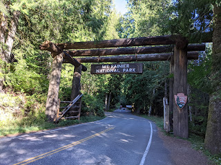
As usual, by waving our senior pass we were waved right in by the Ranger through the Nisqually Entrance, elevation 2023 ft, one of four entrances to the Park, all at the corners of its rectangular shape. We then proceeded on a beautiful 15 mile drive to the Henry Jackson ( a hawkish Democratic Senator from the Cold War period is probably not a good namesake for a national park center) Visitor Center in Paradise. The road was very windy and generally uphill as we rose a bit over 3000 ft in elevation. As the hour was getting late we passed all but one of many turnouts, stopping only at Ricksecker Point, an overlook off a one way loop.It offered spectacular views of a very awesome mountain. 


We then made our way to the Visitor Center and the Paradise Inn by about 10:45. The parking lot was full so we, along with a growing number of other visitors parked along the road. I wonder what happens on summer weekends when there would not be sufficient parking for all the visitors.

The virus strikes again. The Inn and all the other buildings, including the Visitor Center, were closed. There were Rangers outside the Center answering questions and handing out maps.

Everything seems to be named Paradise here. Allegedly, in 1889 when Martha Longmire first saw the southern valley below Mt. Rainier she exclaimed,"Oh, what a paradise." Hence the names. Now, what to do? The map showed a maze of trails on the mountain. The books and the Ranger all raved about the Skyline Trail. It enables one to hike halfway up the tallest active volcano in the contiguous US and the tallest point in the Cascade Mountain Range on a circular trail, so that is what we headed to.

The trail is rated as moderate. The trailhead started with half a dozen steps which had a quote from John Muir etched into them: "...the most luxuriant and the most extravagantly beautiful of all the alpine gardens i ever beheld in all my mountain-top wanderings." The lower part of the trail is paved, so although it was steep at times, it was easy to negotiate. Also on the lower part it crossed many other trails, but fortunately the trail had very good signage and we were able to maintain our clockwise trail path.. Along the trail was a riot of wild flowers and spectacular mountain views.


As we moved up the trail the surprisingly large number of hikers on the paved trail quickly thinned out. Most of the hikers were not wearing masks. About .5 mile up we arrived at a small circular area where the paved trail ended.There were a few strollers and wheelchairs whose trip ended at this point. Off to the left is Alta Vista, but we decided to forgo that view and conserve our energy. It is not uncommon for the views of the 14,410 ft peak of Mt. Rainier to be shrouded in clouds, but on this morning we had a clear view not only of the peak, but also the Tatoosh mountains to the south and the Nisqually Glacier to the north and west. It is the seventh largest glacier on the mountain and covers 1.8 square miles. The 35 remaining glaciers on the mountain are the result of heavy snowfall. In a typical year 634 inches of snow falls in the Paradise area. That exceeds even the vaunted snowfall in the Wasahch range in Utah. The peak was known as Tahoma, or great white mountain, to the local tribes.

At this point the trail was no longer paved and at times it became difficult. We staggered up rocky staircases and the many loose rocks on the trail. Even though it was late August, we came upon snowfields which at times covered the trail. There were many places to stop and observe the breath taking views. We finally arrived at Glacier Vista, 6300 ft. It offered sparkling views of the glacier to the left and the peak straight ahead. 


From this point we could see the people up at Panorama Point, the crown jewel of this hike. However this final part of the trail was rated as strenuous, the trail was getting steeper and rougher and it did not seem to be worth the effort to negotiate the additional 600 ft in elevation and several hairpin turns. So we began the descent. Going down the unpaved portion of the trail was just as hard as going up. Because we did not complete the Skyline Trail Loop we did not get a close up view of Myrtle Falls, but we saw it from a distance.

When we got back down to the Visitor Center we snacked and took a bathroom break, We then searched for an easier, and perhaps less traveled trail.Tthe Ranger suggested the Nisqually Vista trail. It was a good suggestion. The trailhead for that is at the northwestern end of the lower parking lot so we had a short walk to get there. At the entrance to the trail there were two park service building built in the rustic style that appeared to be unoccupied. As promised, on this trail we encountered virtually no other people. Instead we encountered a variety of wildlife, many birds and small mammals and several deer.


There were fields of wildflowers and views of the Nisqually glacier, falls and river.


This area of the park was much lower in elevation than the Skyline Trail and there were many tall trees.


This trail was a 1.2 mile loop that had only a 200 ft gain in elevation, no steps and a well maintained gravel path. Easy on the feet. We walked back to the Visitor Center via the Avalanche Lily Trail and then along the road to our car. It was after 6 and the parking lot had thinned out, but there was still a lot of daylight, so we decided to drive down to Reflection Lake. We could have hiked there but it would have been a 4 mile round trip with elevation. Not doing that at that time of day. Our drive took us on Valley Road and then west on Stevens Canyon Road to a trailhead for the Lakes Trail. We then took a short hike to Reflection Lake. That afforded a nice view of the mountain.


Very few other hikers were there, but none were wearing masks. 

We then drove back toward Ashford past our Inn looking for a place to eat dinner. Riding down the mountain we picked up 16 miles in electricity. The Wild Berry, a Nepalese restaurant received good reviews, was open and was not crowded. So we ate there on the outdoor, covered patio. Good food, reasonably priced and quality service. It was after 9 when we got out of there so we just went back to the Inn.


Driving the 101, Pacific Beaches and Nighttime at the entrance to Mt. Rainier

August 25, 2020 Tuesday

After cooking a big breakfast and packing up we said good-bye to the Olympic Suites Inn, checked out by 9:00 am, left Forks and drove south on 101. Our final destination would be Mt. Rainier, half way across the State of Washington, but I planned to make some stops along the way.


We passed the Hoh River as it entered the Pacific and came to the wild Washington beaches. Our first stop was an overlook and trailhead for Ruby Beach. Unfortunately it was very foggy so we had only a minimum view of the acclaimed beach. Given the thick fog and the steep and rocky trail to the beach we didn't go down to the beach and instead continued south to Kalaloch Beach. This Beach has several entrances and we stopped first at the Beach #6 overlook. Here too it was very foggy, but we walked around the overlook which afforded a good view of the beach. It was very wide and largely sandy with not as many pieces of driftwood as at Rielto Beach. We did not spend a lot of time there.

Our next stop was Beach #4 which had a good trail down to the beach. The trail walk was short and brought us on to a wide, flat (I assume it was low tide) sandy beach, with a foggy view. In some places the sand was very fine. It was an otherworldly view. As we walked on the beach we came to some areas which had lots of dead crabs or crab parts. There were occasional rivets of water rolling down to the ocean and frequently large groups of birds, common murres and tuffed puffins seemed to predominate, either flying above or massed on the ground. During the walk, which occurred in the late morning, we encountered very few people, but saw seastars and anemones in the tidepools.


As we left the beach we encountered a surfer coming in. He said this was a typical weather day and that the beach was usually uncrowded. This beach is part of 65 miles of coastline protected with Olympic National Park. From the beach a marine sanctuary extends 135 miles north and south and from 20 to 50 miles offshore.

Returning to the car we continued south along the ocean on the 101. We passed the Kalaloch Lodge, a nice looking wooden structure just off the beach. Looked like a nice place to stay. As we passed  South Beach we left the beach part of the Park and approached Queets. At that point the 101 turned east and we drove along the southern boundary of the Park.  We passed the entrance to the Quinault Rain Forest, but had to forego that attraction since we still had a long way to travel. 

We continued east and drove through Aberdeen. The town was named for the Scottish city and lies at the head of the expansive Gray's Harbor. As we drove through we crossed several river bridges and observed many handsome Craftsman and Victorian style homes.  On the outside of town we stopped and purchased food for lunch. A few miles out of town we stopped at Twin Bridges County Park for a picnic lunch. 


The Park had recently been renovated so we ate on a new picnic table and took a brief hike on a new trail down to an along the river.

We then proceeded east on 107, skirted around Tacoma, drove a short stretch north on I-5 and then east along increasingly scenic roads to the southern entrance to Mt Rainier  National Park. We drove through the small town of Ashford and stopped a few hundred yards east of the park entrance where we  checked into the Gateway Inn. The Inn is an older facility with a main lodge and about a dozen cabins set in a forest of towering trees. We were given a small suite with a small kitchenette on the second floor. The outlet on the light tower did not have enough current to power the car and the Inn would not let me plug into the outlets for RVs even though many were vacant. 

After unpacking I walked to the park entrance and picked up a park map. We ate dinner out of the cooler.  I took an evening walk among the tall trees and made some phone calls. The telephone reception during the walk was poor and the internet reception in the room was even worse.