Day 4 June 9, 2017 Crater Lake to Ashland
It was cool and overcast when we awoke so, we hung out in
the Lodge's Great Hall for a few hours enjoying the fireplace and the surroundings and
reading the paper and emails. The internet was spotty, but no urgency.
Breakfast consisted of some fruit and cheese


 that we had been hauling around
and hotel drinks.
that we had been hauling around
and hotel drinks.


The Lodge was opened in 1915 shortly after the area was
declared a National Park. It closed in the 1990s for major renovation. It is
open only from May to October and hard to get reservations. The Great Hall has
a massive stone fireplace and there are additional fireplaces in the Lobby and
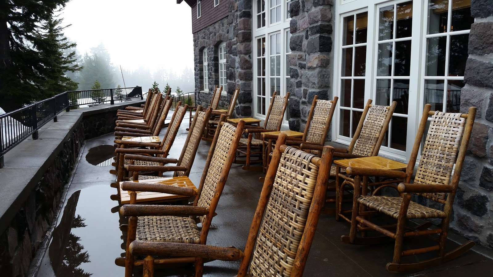
dining room. The back of the Lodge has a breathtaking view of the Lake. Rocking
chairs on the large back porch offer a relaxing, and in my two experiences a
chilly, view of Crater Lake’s deep blue waters.
The Lake was formed when the top of a volcano imploded and the
resulting crater gradually filled with water. I think it is the deepest lake in
the continental US. It is replenished solely by rain and snowmelt, so it is clean
and clear. However, about a century ago it was stocked with two varieties of
fish. (The Ranger conceded that was a mistake.) It is so large that it creates
its own mini climate
We had a lengthy conversation with a tall female hiker. She
has been hiking portions of the Pacific Crest Trail which runs through Crater
Lake Park, although not close to the Lodge (it also runs through Lassen,
although this time of year it was snow covered there.), but doing it
“backwards”, from the north rather than the typical south to north route. She
was not staying in the Lodge, but was there to get the free coffee and out of
the cold. She had hiked several h hundred
miles of the Trail and was thinking of returning to her husband in Seattle. The
Trail runs through the Park, but not very close to the Lodge. I could not
figure out where she had spent the night or how she had gotten to the Lodge so
early since the nearest campgrounds in the Park were several miles away and she
did not appear to have a car. She spoke
very disparagingly of the woman who’s hiking the trail had been the subject of
a book and movie (“Wild”) staring Reese Witherspoon) claiming that she had
hiked less than half the trail and had failed to properly understand what such
a hike required, e.g., bought too big a pack and then overloaded it.
After checking out and loading up the car, we took a hike
around the rim road, now closed to auto traffic and not open all around the
Lake due to snow. It was intermittently sunny, but brisk. The road we were
walking on frequently had steep and tall walls of snow lining it. We took several side trips to the lake’s edge over the snow and were rewarded with
breathtaking views of the Lake and Wizard Island. We walked a few miles until
we came to a road repair crew. One member was holding a large stop sign even
though there was no vehicular traffic. We could have gone beyond them, but
instead we turned around and then drove down the mountain to the Visitor
Center.
At the Visitor’s Center, we watched a movie and wandered
through the gift shop. One of the Rangers was very talkative. I purchased a
book on lodges in the national parks. Never found the charging station.
We drove west on highway 62 descending through beautiful
green forest. We passed through some very small towns but could not find a
grocery to purchase a picnic lunch. Finally, we went into a park/marina where we purchased
and ate lunch by the water.
Made a side trip to a small, relatively new, winery off
route 227. Tasted our flight of Oregon wines and then purchased a couple of
bottles and a corkscrew. We attempted to go to a noted cheese shop, the
Creamery, in Crown Point, a very non-descript town, but we just missed closing
time.
We arrived at our motel in Ashland about 6. We stayed about
2 miles from the center of town at the Roadway Inn. Nothing special, but at our
request we were given a room at the end on the first floor so we could charge
up the car from in the room. I
replenished our food supply from a local supermarket. Turkey and cheese lettuce
wraps in the room, along with our newly purchased wine for dinner avoiding a
rainstorm.


